Introduction to Cumnor’s landscape
Maps of Cumnor
Click on maps to enlarge them !
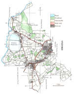
Large scale map of Cumnor and environs
Geological map of Cumnor and environs
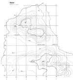
Relief map of Cumnor and environs.
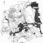
Map of Cumnor and environs.
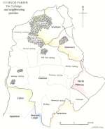
Cumnor Parish. The Tythings and neighbouring parishes
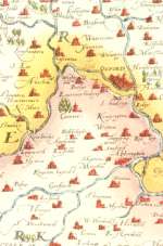
From Saxton's Map 1574
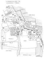
Cumnor Village 1726, reconstruction : J.Hanson
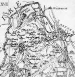
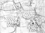
Rocque 1760, Cumnor and neighbouring parishes
Rocque 1760. The centre of the parish
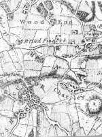
Cumnor 1808 (from Bodleian Ms Maps Berks a. 5r)
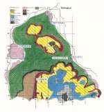
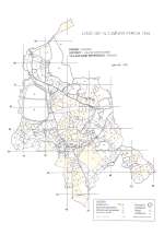
Land Use in Cumnor Parish, 1994
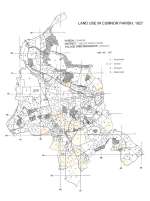
Land Use in Cumnor Parish, 1927
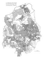
Field Systems
Cumnor & Wytham 1300
Reconstruction J. Hanson
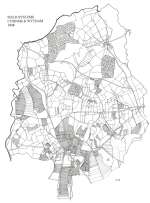
Field Systems
Cumnor & Wytham 1808
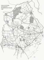
After Enclosure in 1814
Field Systems post Enclosure
Cumnor & Wytham 1820
Cumnor Parish Poster & Map
Promoting Conservation
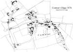
Cumnor village 1876
Based on O.S, map