|
|
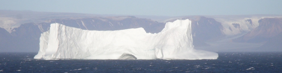
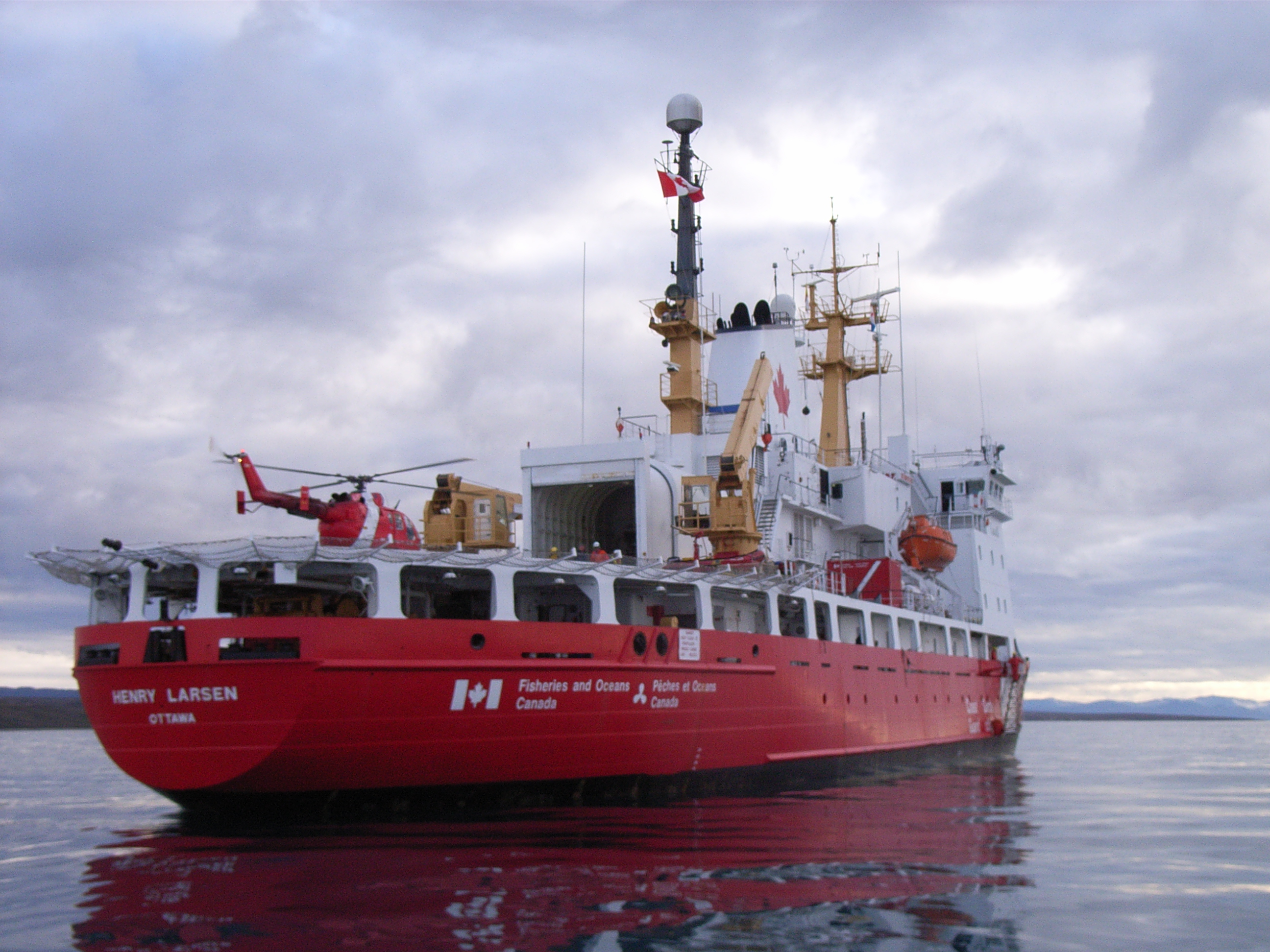 | For three weeks in August 2007 I will be aboard the CCGS Henry
Larsen, a Canadian coastguard icebreaker, to recover and redeploy
oceanographic instruments in the Canadian
Arctic Archipelago. Most of the time will be spent in Nares
Strait, which lies between Greenland and Ellesmere Island. This is
one of three major passages to the west of Greenland which connect the
Arctic to the Atlantic, through which relatively fresh sea water and
ice flows southward. We aim to measure this flow and understand what
drives it.
This summer's expedition is part of the NSF-funded Canadian Archipelago Throughflow Study, which began in 2003. It is also an International Polar Year project. Life at sea will be busy, but I will try to use this page to keep a diary of what we get up to! To see a higher resolution version of any image simply click on it. See here for some background science and further details on the influence of the fresh Arctic outflow into the Atlantic...... |
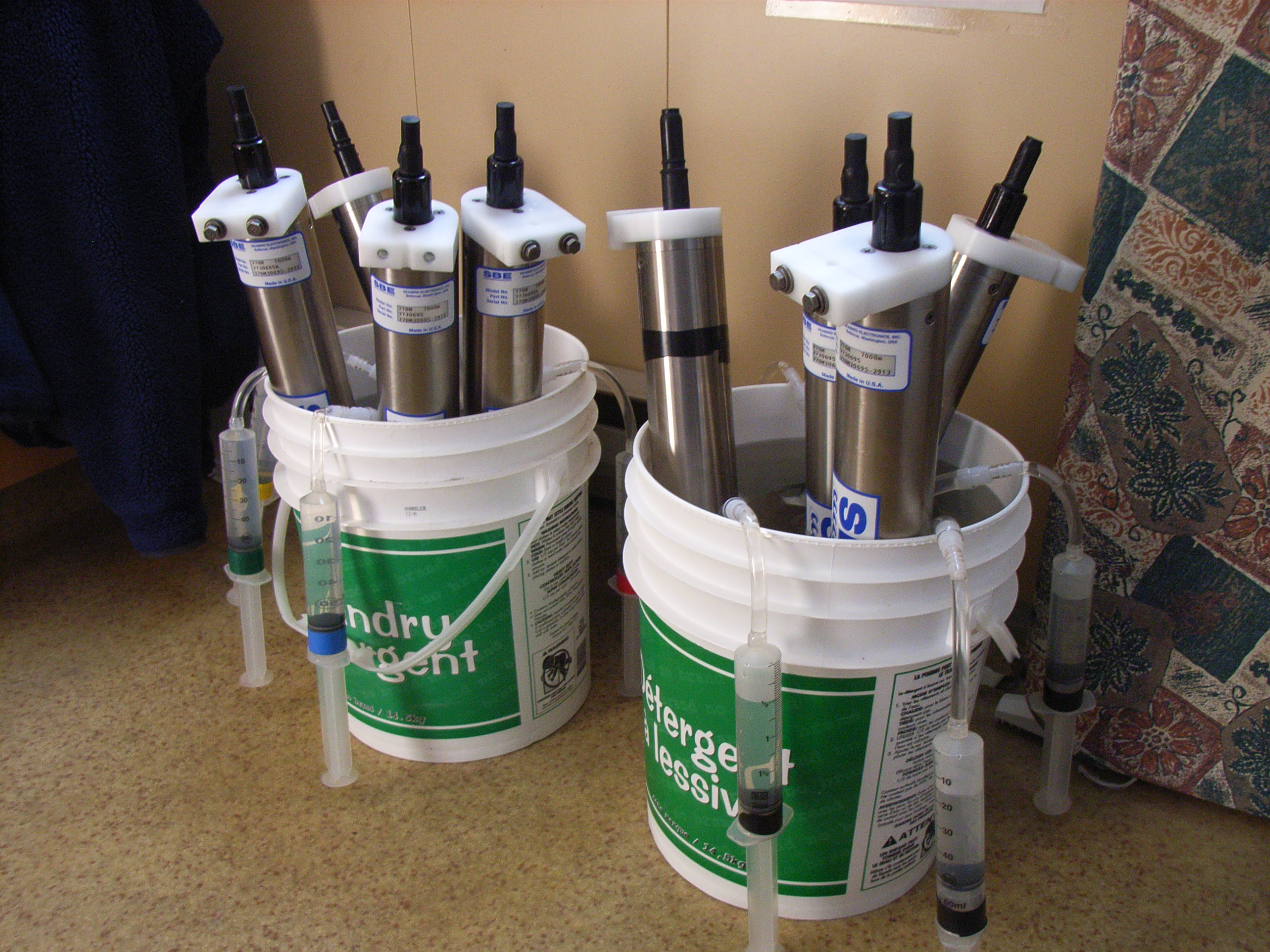
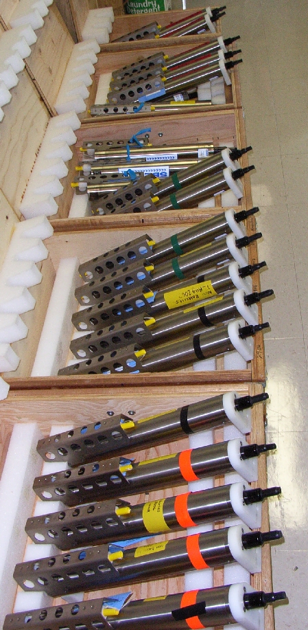
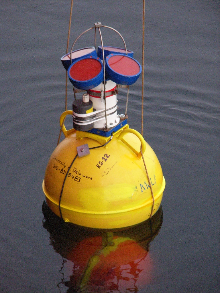
| We'll be working with several different types of instrument during this project. First, there's the SBE37 conductivity, temperature and pressure recorder - we've got more than 30 of these, most of which are deployed in sets of four on "string" moorings which reach from the bottom of the strait to within 30m of the surface. Here's a picture of some we recovered last year - some get a lot of biological growth on them, and a large part of servicing these instruments involves removing this from the inside of the conductivity cells. |
|
 | Then there's the Acoustic Doppler Current Profiler (ADCP) moorings, which sit on the bottom looking upwards, and use the doppler effect to measure the velocity of the water flowing above them. They give us a vertical profile of flow speed through the whole water column. |
|
|
|
|
|
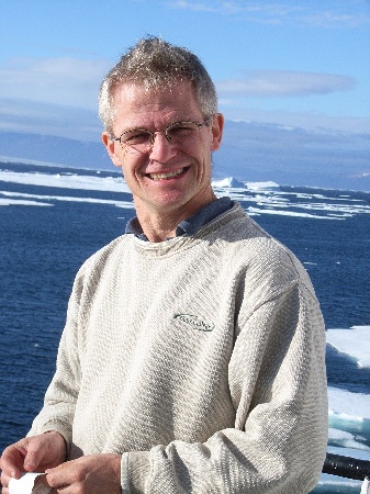
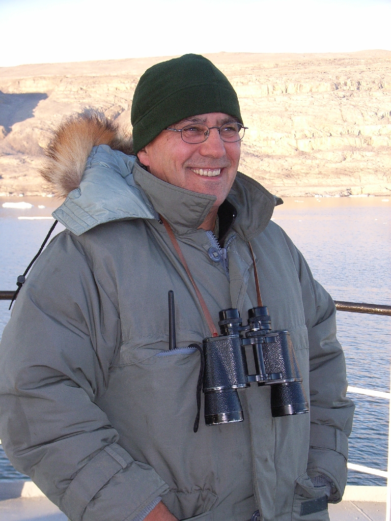
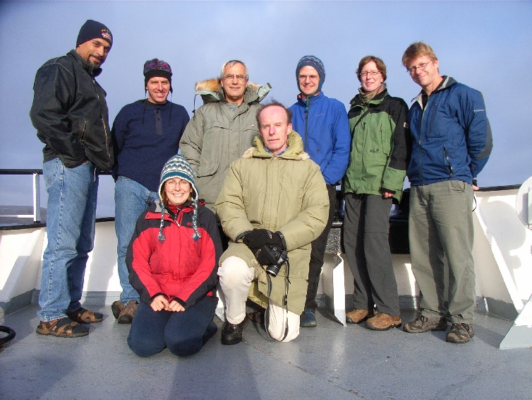
Humfrey Melling the Chief Scientist, from the Institute of Ocean Sciences in Sidney, BC, Canada (IOS) |
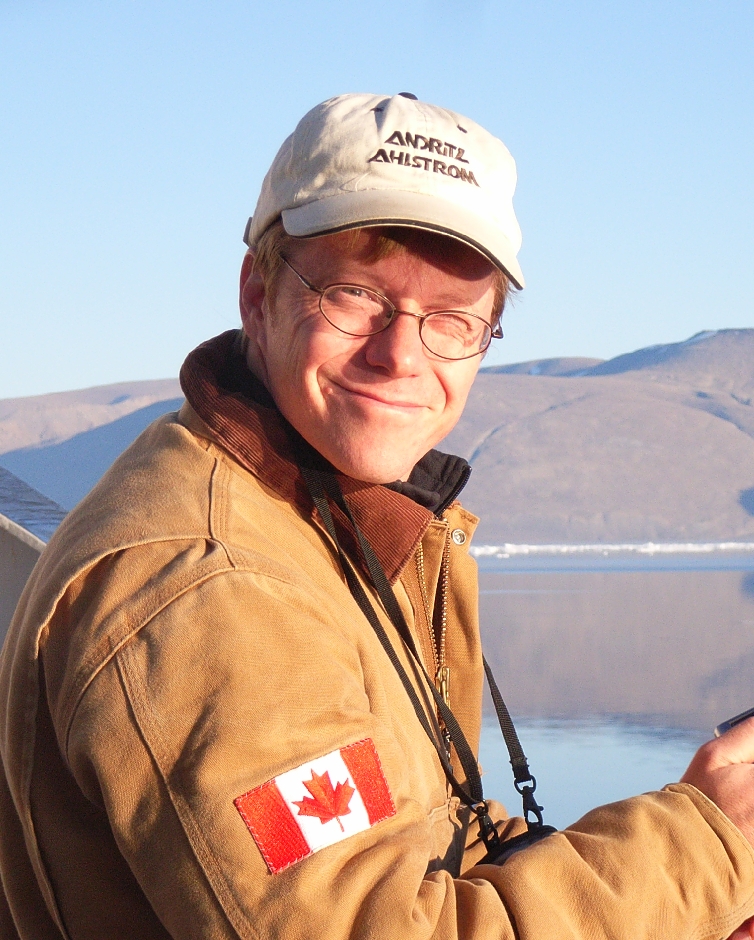
Andreas Muenchow the Principal Investigator on the project, from the University of Delaware, US |
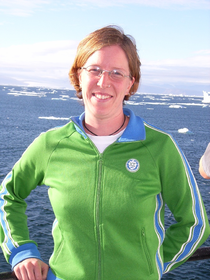
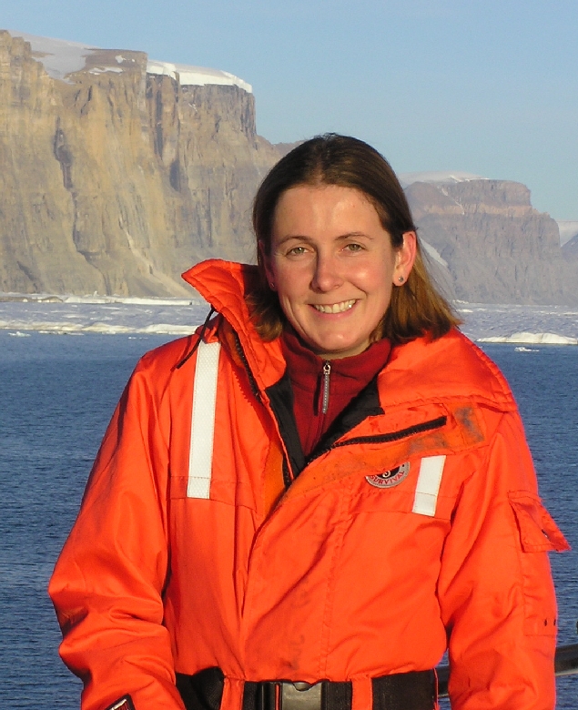
Berit Rabe a graduate student at the University of Delaware |
Jo Poole a mooring technician from IOS |
|
|
|
|
|
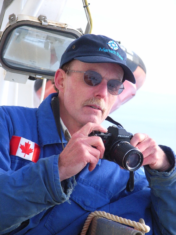
Ron Lindsay an electronics and instrument technician from IOS |
Dave Riedel a scientist from IOS |
Dave Spear a mooring technician from IOS |
.......me! |
| Also part of the science team are Michelle and Richard from the National Research Council Canada. Michelle is an ice scientist interested in the change in properties of multi-year sea-ice as it flows south, and on the forces this ice produces on the ship's hull. |
|
|
|
|
Michelle Johnston ice scientist from the National Research Council Canada (NRCC) |
Richard Lanthier technician from NRCC |
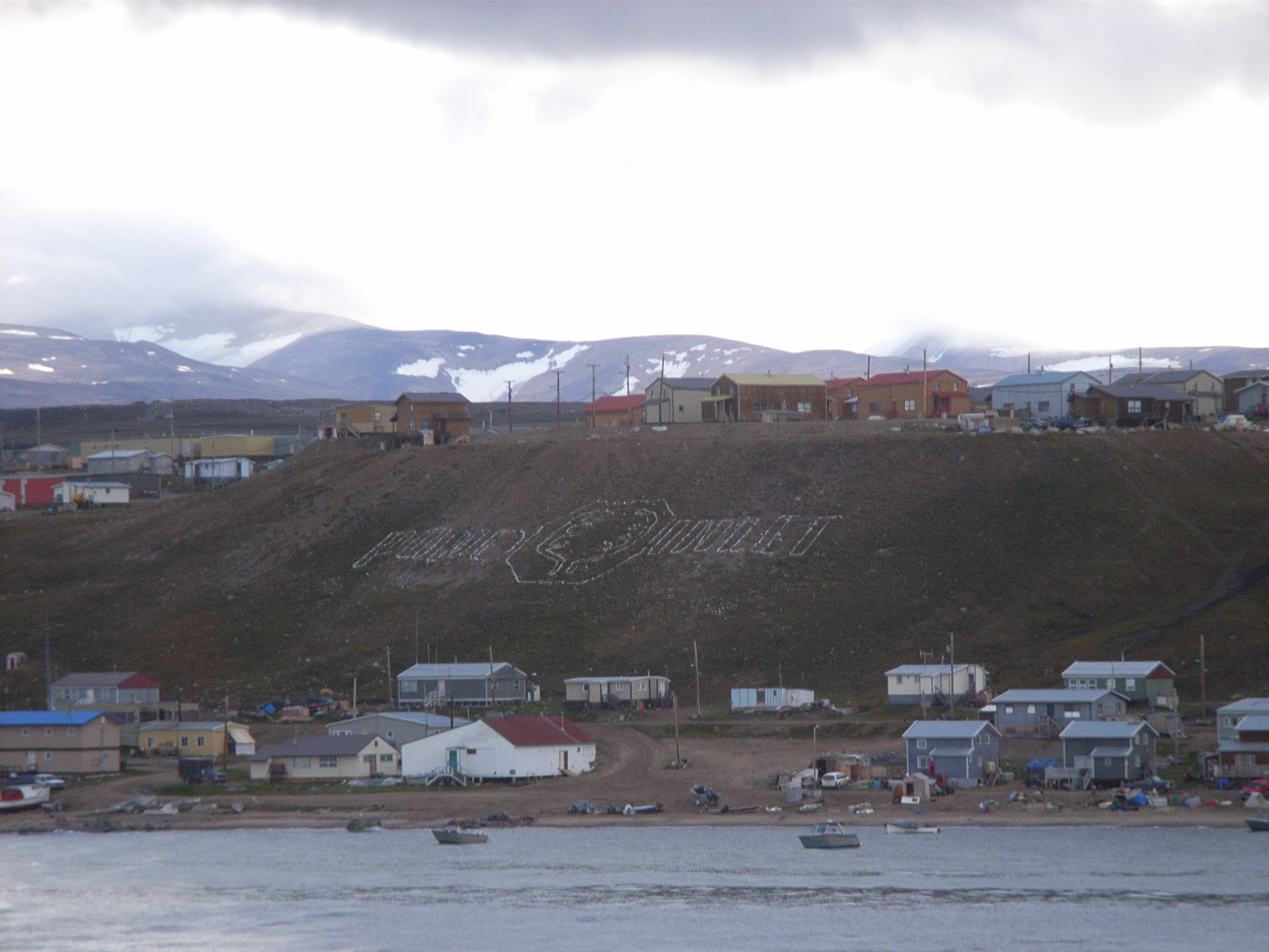
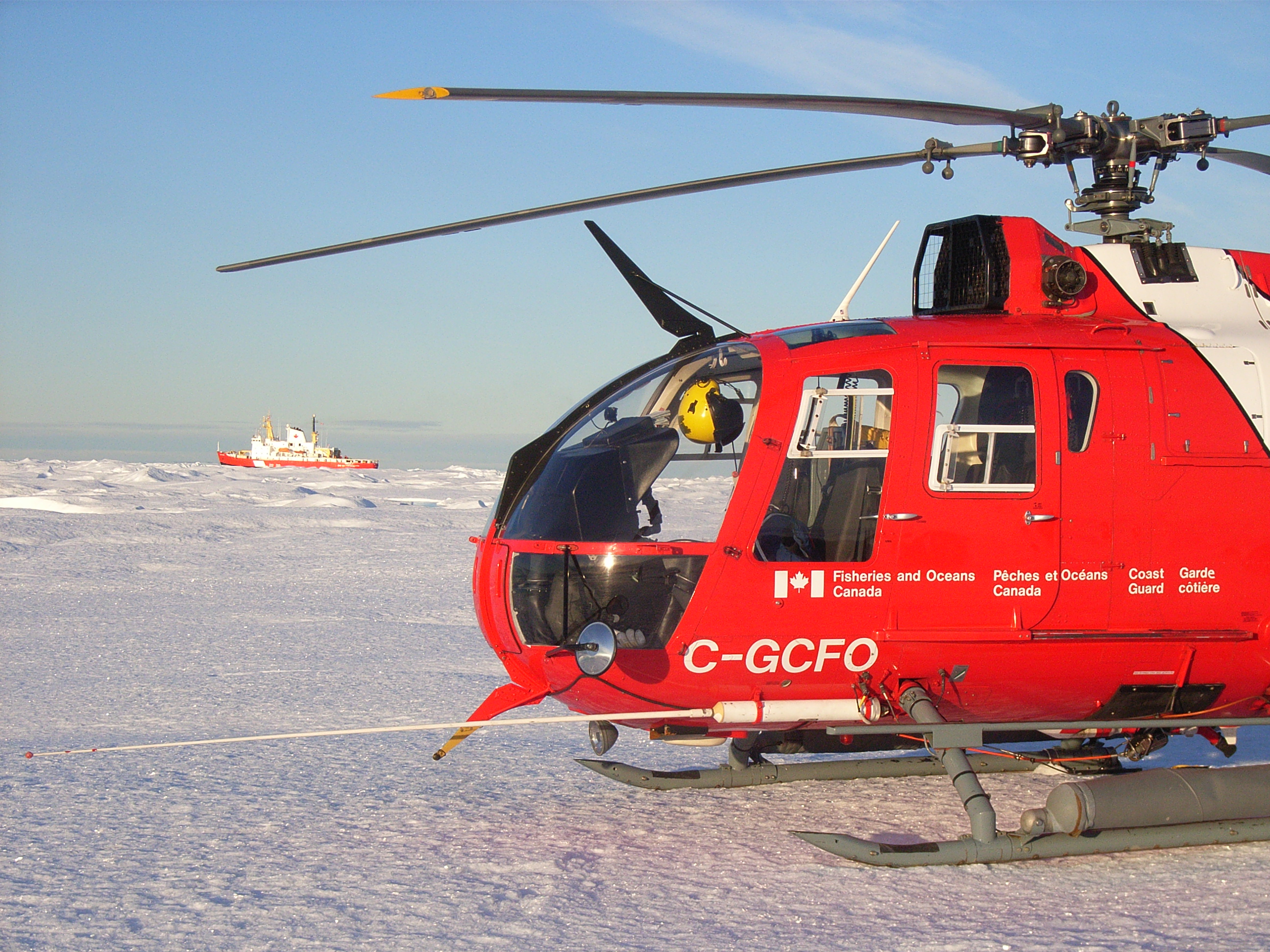
 Up at 4am this morning to catch a charter flight from St. John's up to
Thule in Greenland. The coastguard crew on the Larsen are changing
over at the end of one six week shift and the beginning of another, so
we caught a ride on the plane which brought the new crew north. It's
always a strange feeling at this stage to be surrounded by the 40 or
so Newfoundland strangers that are going to be the only people I see
over the next few weeks! I'm looking forward to getting to know them
well (once I can start to understand their accent?). I'm also excited
to see the rest of the science party again, most of whom I HAVE sailed
with before - they are a great bunch of people to work with!
Up at 4am this morning to catch a charter flight from St. John's up to
Thule in Greenland. The coastguard crew on the Larsen are changing
over at the end of one six week shift and the beginning of another, so
we caught a ride on the plane which brought the new crew north. It's
always a strange feeling at this stage to be surrounded by the 40 or
so Newfoundland strangers that are going to be the only people I see
over the next few weeks! I'm looking forward to getting to know them
well (once I can start to understand their accent?). I'm also excited
to see the rest of the science party again, most of whom I HAVE sailed
with before - they are a great bunch of people to work with!
 I'd forgotten how much heavy lifting there always is to do on day one
of a trip like this! Most of the science gear arrived on the ship in
two large containers, and we've spent today unpacking and finding a
proper secure home for everything. The containers will then be used
as workshops on the deck - one for the delicate electronics work, and
the other for assembling all the instrument frames and hardware.
We've unpacked lots of mooring components, including bright coloured
floats up to a metre in diameter and tens of extremely heavy boxes
full of battery packs and instruments. I've managed to track down
most of the things I'll need for servicing, testing and re-programming
the SBE37s, and we're slowly getting organised!
I'd forgotten how much heavy lifting there always is to do on day one
of a trip like this! Most of the science gear arrived on the ship in
two large containers, and we've spent today unpacking and finding a
proper secure home for everything. The containers will then be used
as workshops on the deck - one for the delicate electronics work, and
the other for assembling all the instrument frames and hardware.
We've unpacked lots of mooring components, including bright coloured
floats up to a metre in diameter and tens of extremely heavy boxes
full of battery packs and instruments. I've managed to track down
most of the things I'll need for servicing, testing and re-programming
the SBE37s, and we're slowly getting organised!
|
|
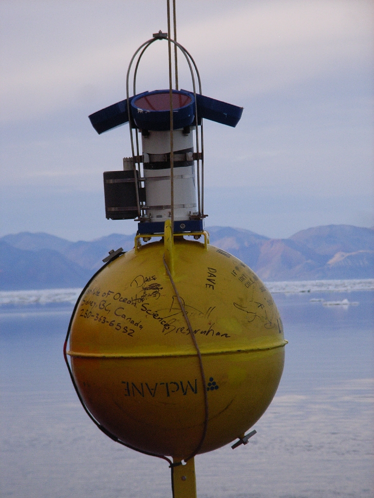
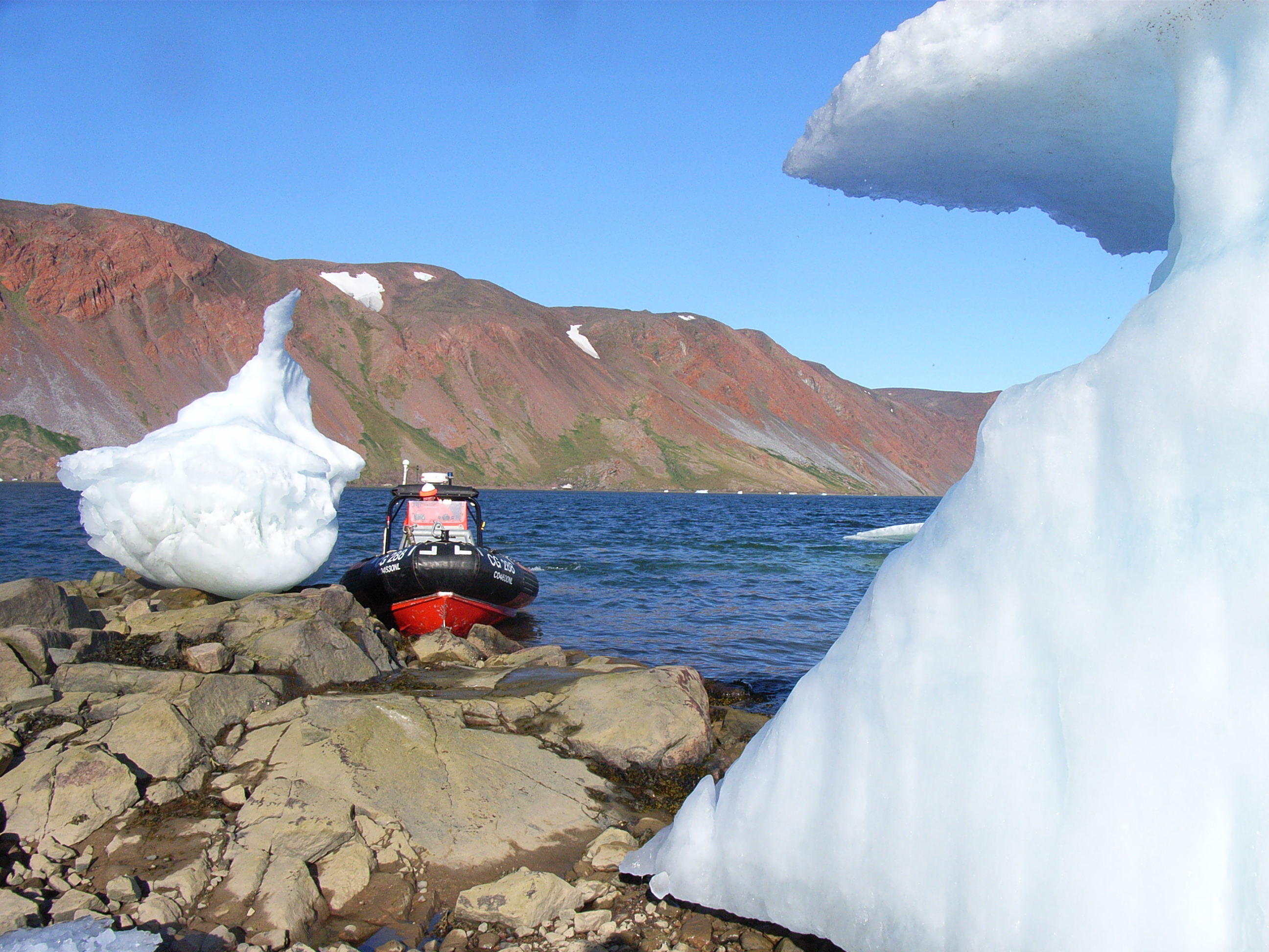
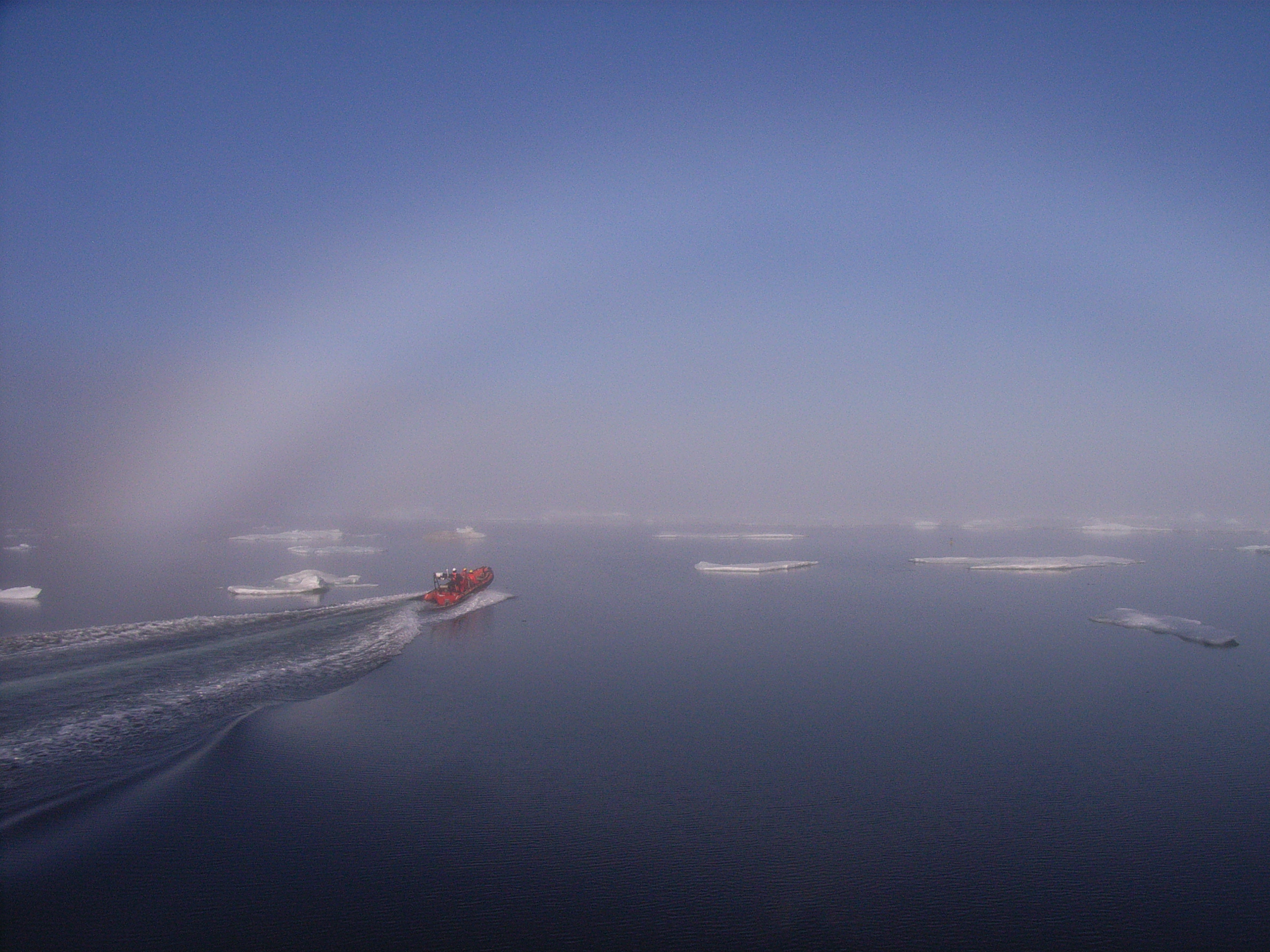
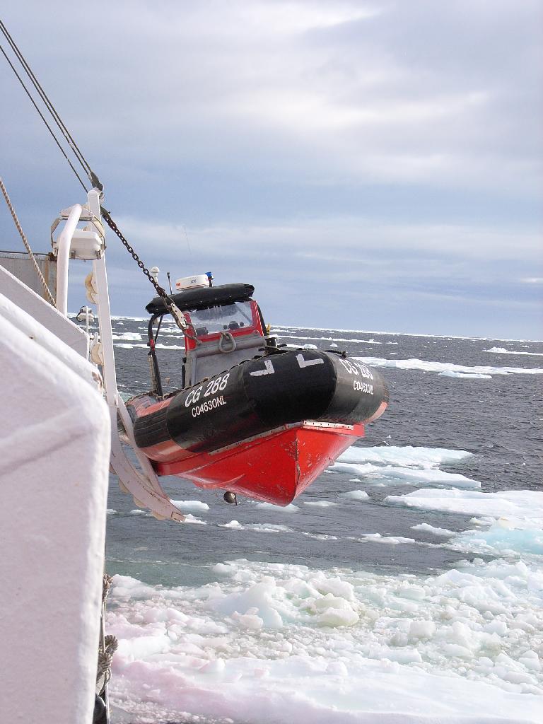 The highlight of my day today was a trip in the FRC (fast response craft, or
rigid inflatable boat) to Foulke Fjord on the Greenland side of Smith Sound.
We were trying to recover a shallow pressure mooring that was deployed there
last year. These moorings sit on the sea floor at a depth of about 20m in
sheltered bays and, essentially, measure the change in sea level above them.
From this we're hoping to be able to calculate the pressure gradients along
and across the strait, and see how these relate to the amount of water
flowing through. We weren't successful today - maybe the instrument has
been scoured out by the grounded icebergs we could see all around? Or
perhaps the acoustic release hook holding it to the bottom isn't working
properly (more about these acoustic releases later!). But it was still an
incredible experience :-) The FRC is launched from the boat on an open-air
elevator of sorts which whistles down the side of the ship until it hits the
water, and then there's a bouncy ride to your destination.
The highlight of my day today was a trip in the FRC (fast response craft, or
rigid inflatable boat) to Foulke Fjord on the Greenland side of Smith Sound.
We were trying to recover a shallow pressure mooring that was deployed there
last year. These moorings sit on the sea floor at a depth of about 20m in
sheltered bays and, essentially, measure the change in sea level above them.
From this we're hoping to be able to calculate the pressure gradients along
and across the strait, and see how these relate to the amount of water
flowing through. We weren't successful today - maybe the instrument has
been scoured out by the grounded icebergs we could see all around? Or
perhaps the acoustic release hook holding it to the bottom isn't working
properly (more about these acoustic releases later!). But it was still an
incredible experience :-) The FRC is launched from the boat on an open-air
elevator of sorts which whistles down the side of the ship until it hits the
water, and then there's a bouncy ride to your destination.
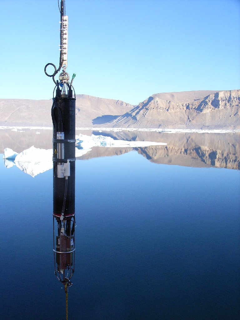 Today has been a day of nights! Dave Riedel and I operated the CTD from
1-7am this morning on a section across the sill in Kane Basin. It was
perfectly calm and beautifully sunny so it didn't feel like a night shift at
all (although by 7am we were definitely flagging!). A CTD section involves
stopping the ship at a series of stations, where we lower our CTD instrument
to the bottom using a small winch, measuring conductivity, temperature and
pressure every 10cm or so on the way down. The data is sent back up the
winch cable so that we can look at the numbers as they come in (and let the
winch operator know when he's getting to the bottom - the last thing we want
to do is crash our newly-mended CTD into the mud and rocks!) On other
ships, the CTD is often accompanied by a rosette of bottles for collecting
water from different depths, but we have a fairly simple system without that
here.
Today has been a day of nights! Dave Riedel and I operated the CTD from
1-7am this morning on a section across the sill in Kane Basin. It was
perfectly calm and beautifully sunny so it didn't feel like a night shift at
all (although by 7am we were definitely flagging!). A CTD section involves
stopping the ship at a series of stations, where we lower our CTD instrument
to the bottom using a small winch, measuring conductivity, temperature and
pressure every 10cm or so on the way down. The data is sent back up the
winch cable so that we can look at the numbers as they come in (and let the
winch operator know when he's getting to the bottom - the last thing we want
to do is crash our newly-mended CTD into the mud and rocks!) On other
ships, the CTD is often accompanied by a rosette of bottles for collecting
water from different depths, but we have a fairly simple system without that
here.
 After a few hours sleep, I spent the afternoon reading the manual for
the SBE37 conductivity and temperature recorders - to remind myself
how to program them for deployment which is one of my next jobs. It's
a very dry read, but lovely to be sat outside on deck in sunny
Scoresby Bay while Ron and Dave were off in the FRC attempting to
recover another pressure mooring. I even had to dig out my suncream!
Sadly, they didn't have any more luck with this mooring than the last,
and after lots of effort trying to drag for it were forced to give up
on that too....at least for now.
After a few hours sleep, I spent the afternoon reading the manual for
the SBE37 conductivity and temperature recorders - to remind myself
how to program them for deployment which is one of my next jobs. It's
a very dry read, but lovely to be sat outside on deck in sunny
Scoresby Bay while Ron and Dave were off in the FRC attempting to
recover another pressure mooring. I even had to dig out my suncream!
Sadly, they didn't have any more luck with this mooring than the last,
and after lots of effort trying to drag for it were forced to give up
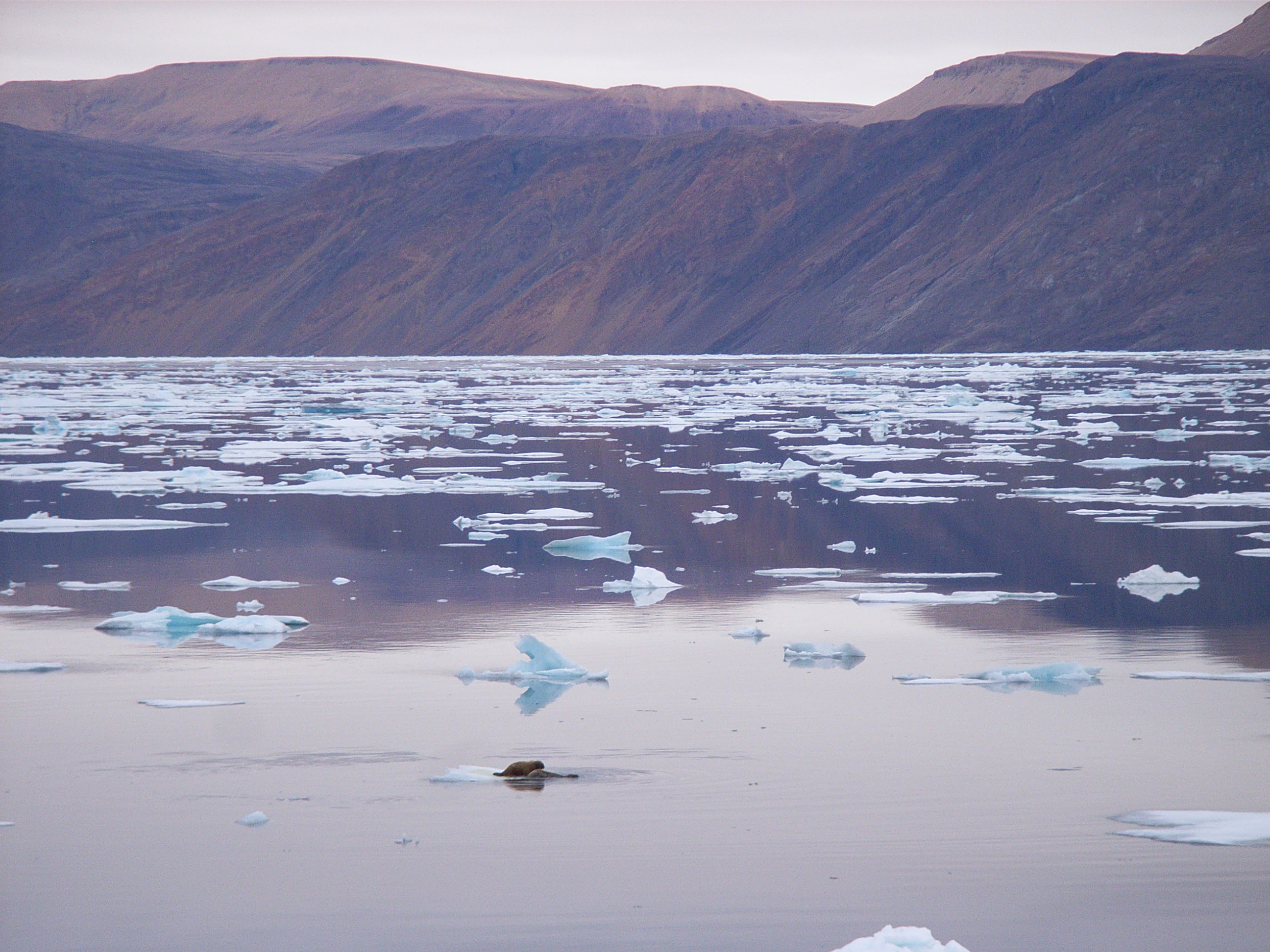
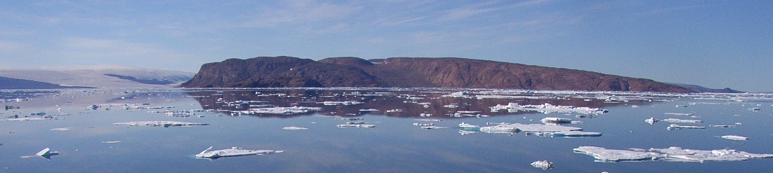
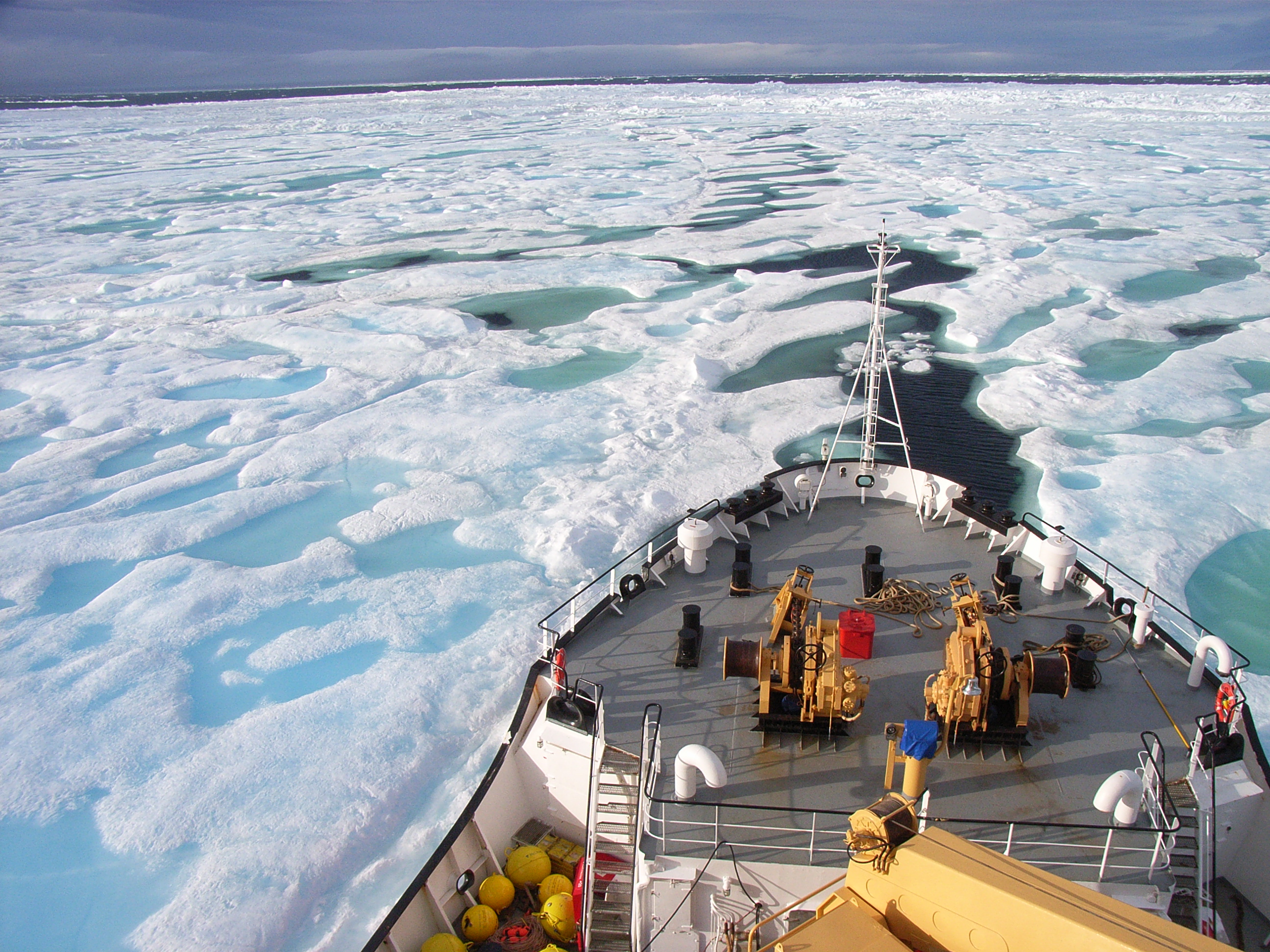
on that too....at least for now. 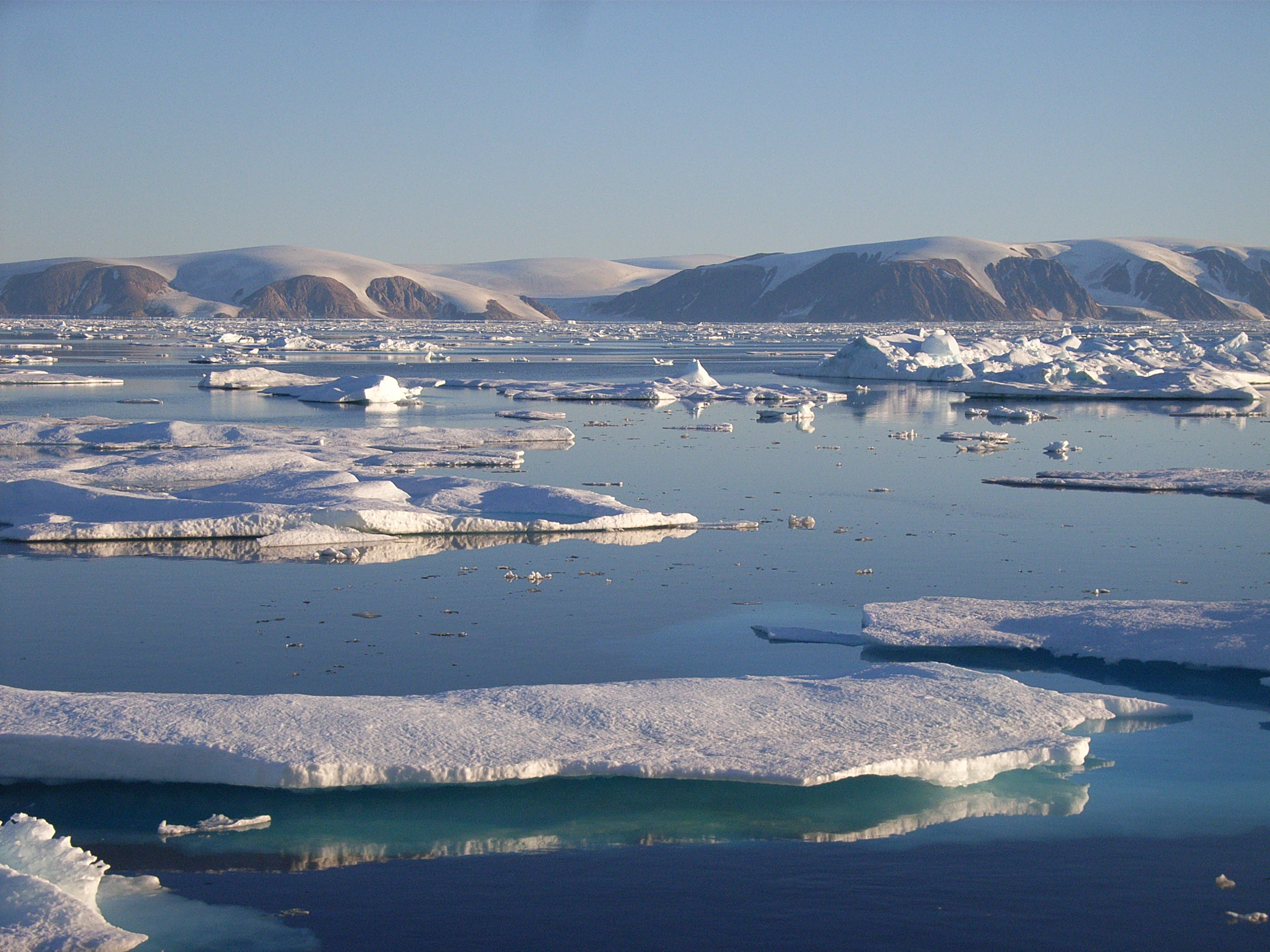 We've been steaming south as fast as we can today, only slowing when
there's lots of ice around. We're now in Jones Sound, bound for Grise
Fjord on the southern end of Ellesmere Island - the view of Coburg
Island off to our starboard side is incredible! Most of my day has
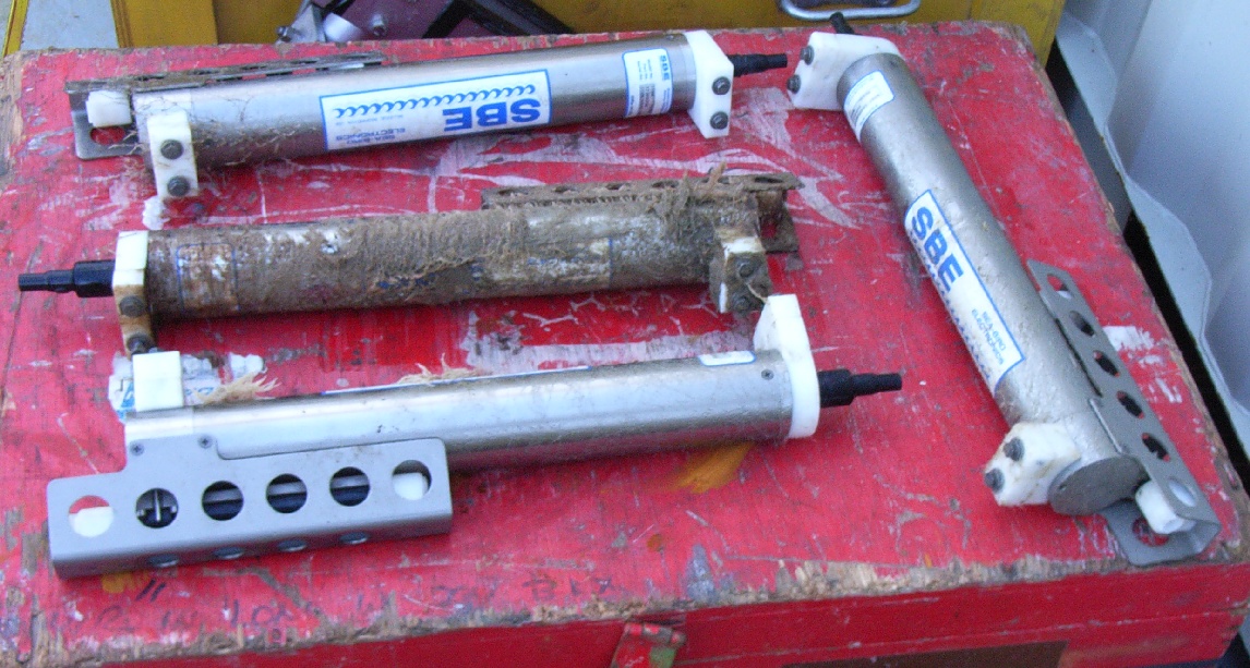
been taken up with testing our acoustic release system. Each of the
moorings already in the water (as well as those we plan to deploy) is
held to its anchor by a latch which can be opened by sending it a
sound signal. We call these devices "acoustic releases" since, when
the hook is opened, the mooring is released from the bottom and the
buoyant floats attached to it will bring it to the surface. The
picture shows two acoustic releases from a mooring we recovered last
year.
We've been steaming south as fast as we can today, only slowing when
there's lots of ice around. We're now in Jones Sound, bound for Grise
Fjord on the southern end of Ellesmere Island - the view of Coburg
Island off to our starboard side is incredible! Most of my day has
been taken up with testing our acoustic release system. Each of the
moorings already in the water (as well as those we plan to deploy) is
held to its anchor by a latch which can be opened by sending it a
sound signal. We call these devices "acoustic releases" since, when
the hook is opened, the mooring is released from the bottom and the
buoyant floats attached to it will bring it to the surface. The
picture shows two acoustic releases from a mooring we recovered last
year.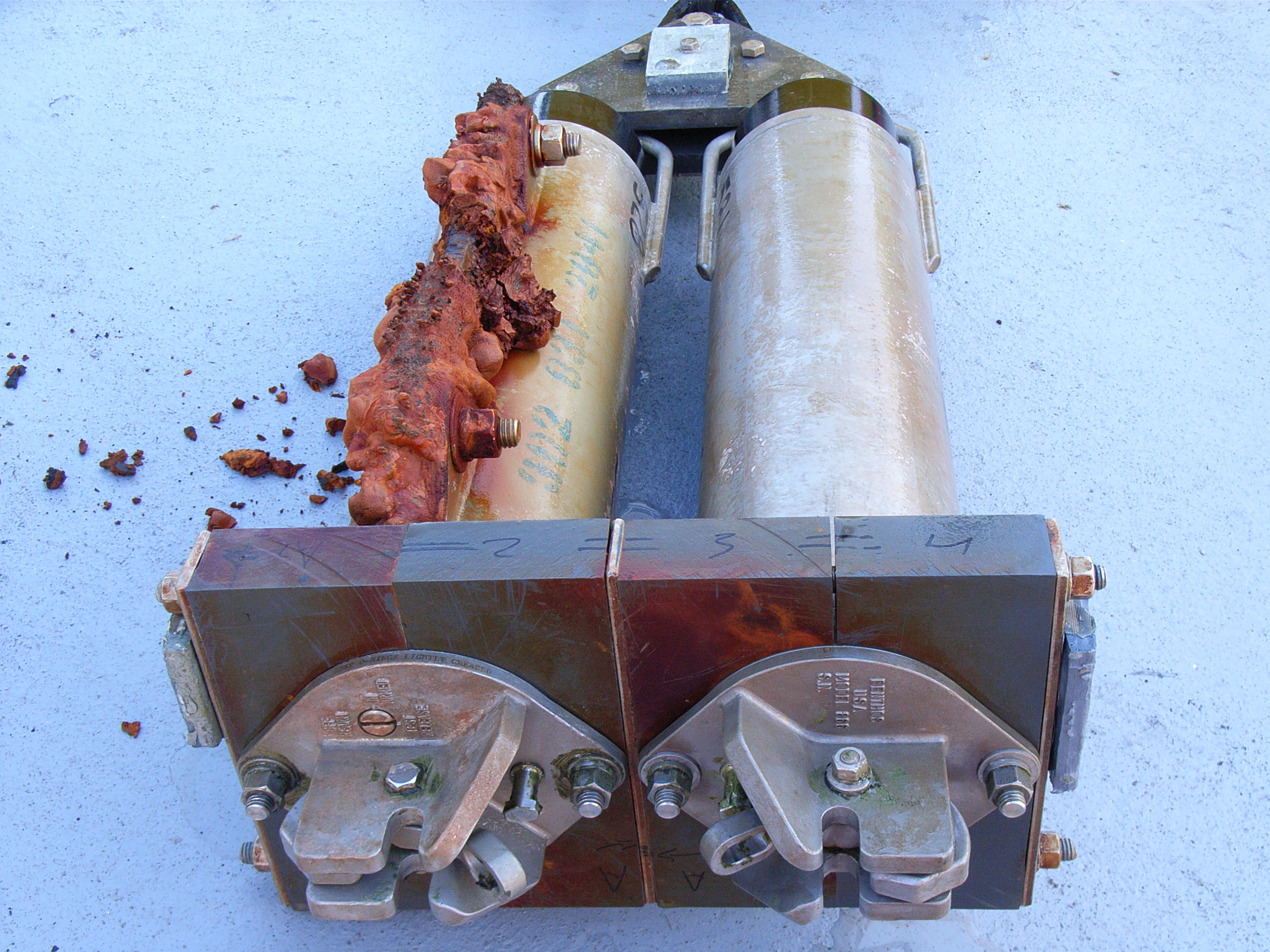 To communicate with an acoustic release, we dangle a hydrophone or
transducer over the side of the ship and send pulses of sound at very
specific frequencies (in the 9-14 kHz range) - the release will reply by
sending a pulse of sound back (at a slightly different frequency). We can
calculate how far away the release is if we know the time it takes for its
response to arrive. Once we know exactly where the release is (and if there
isn't a huge ice floe sat directly above it!) we send it a coded sound
signal and the release mechanism operates, freeing it from the bottom. Then
it's just a case of spotting the instrument when it gets to the surface!
To communicate with an acoustic release, we dangle a hydrophone or
transducer over the side of the ship and send pulses of sound at very
specific frequencies (in the 9-14 kHz range) - the release will reply by
sending a pulse of sound back (at a slightly different frequency). We can
calculate how far away the release is if we know the time it takes for its
response to arrive. Once we know exactly where the release is (and if there
isn't a huge ice floe sat directly above it!) we send it a coded sound
signal and the release mechanism operates, freeing it from the bottom. Then
it's just a case of spotting the instrument when it gets to the surface!
 It's been great to have a little time off to take advantage of the
social side of things. For the coastguard crew on board, the Larsen
is home for half the year, and there are lots of things to keep them
occupied during their spare time. As well as the dartboard, there's a
table football set, a gym, enough movies to last a lifetime, a small
bar open for 2 hours each evening, a sauna and even a Wii (for those
not in the know, this is an electronic games system which seems to
involve players standing in the middle of the lounge pointing at the
TV and swinging their arms around - one way to get exercise I
suppose!). Darts is just the start of the tournaments this trip -
crib and poker are also under way, and Saturday night is bingo night.
We will no doubt be way too busy to sample all that's on offer, but
it's nice to have a distraction now that we've got a couple of slower
days.
It's been great to have a little time off to take advantage of the
social side of things. For the coastguard crew on board, the Larsen
is home for half the year, and there are lots of things to keep them
occupied during their spare time. As well as the dartboard, there's a
table football set, a gym, enough movies to last a lifetime, a small
bar open for 2 hours each evening, a sauna and even a Wii (for those
not in the know, this is an electronic games system which seems to
involve players standing in the middle of the lounge pointing at the
TV and swinging their arms around - one way to get exercise I
suppose!). Darts is just the start of the tournaments this trip -
crib and poker are also under way, and Saturday night is bingo night.
We will no doubt be way too busy to sample all that's on offer, but
it's nice to have a distraction now that we've got a couple of slower
days. 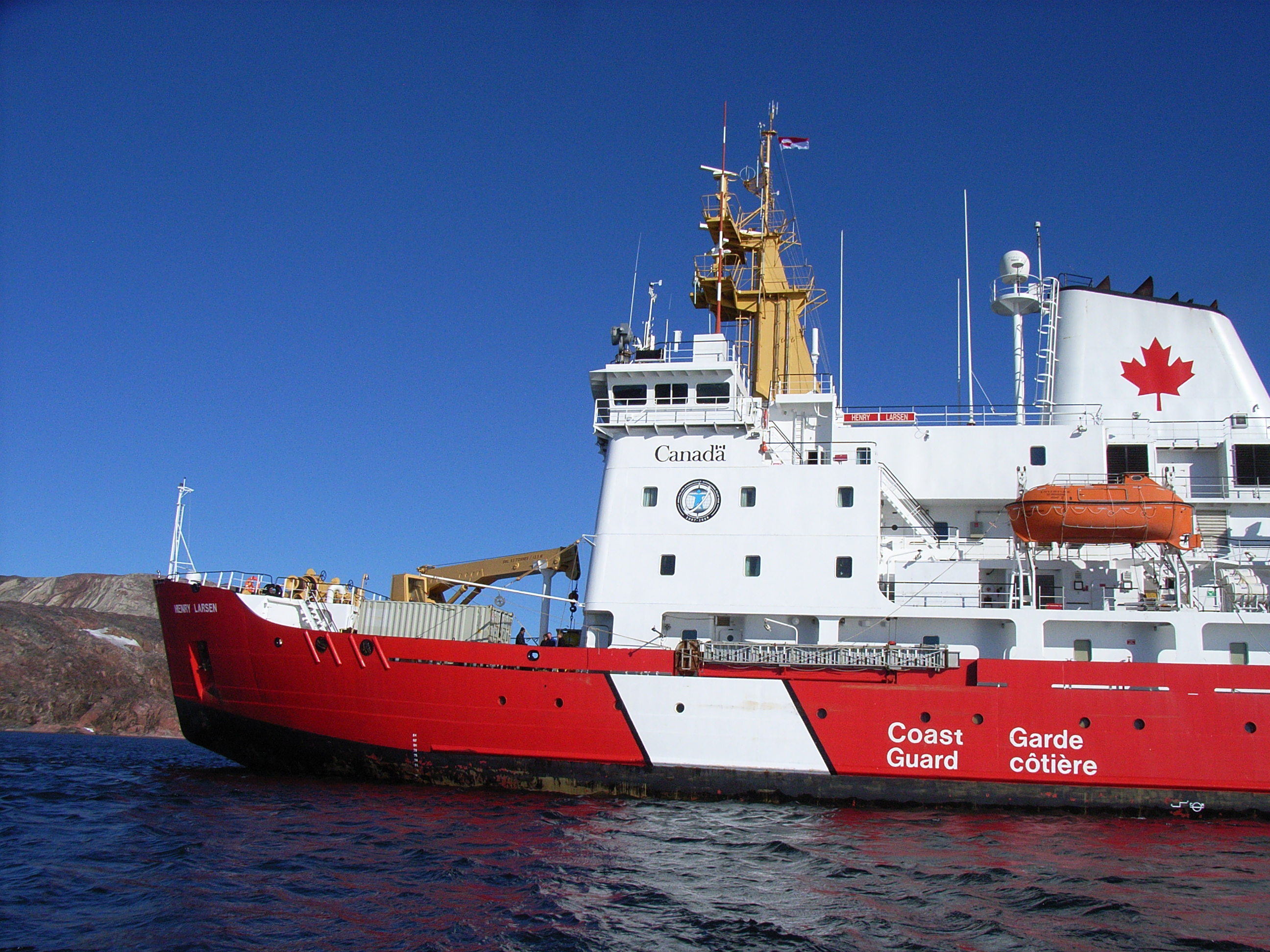 The St. Roch, with a crew of eight, set out heading east. They were
forced to overwinter twice when trapped in the ice, freeing themselves
on the second occasion only by using gunpowder charges to break up the
ice around the bow. They stopped off at Pond Inlet on Baffin Island
to make repairs after one of the ship's cylinders blew, but eventually
arrived triumphant in Newfoundland in September 1942 after a voyage of
more than two years.
The St. Roch, with a crew of eight, set out heading east. They were
forced to overwinter twice when trapped in the ice, freeing themselves
on the second occasion only by using gunpowder charges to break up the
ice around the bow. They stopped off at Pond Inlet on Baffin Island
to make repairs after one of the ship's cylinders blew, but eventually
arrived triumphant in Newfoundland in September 1942 after a voyage of
more than two years.
|
|
|
|
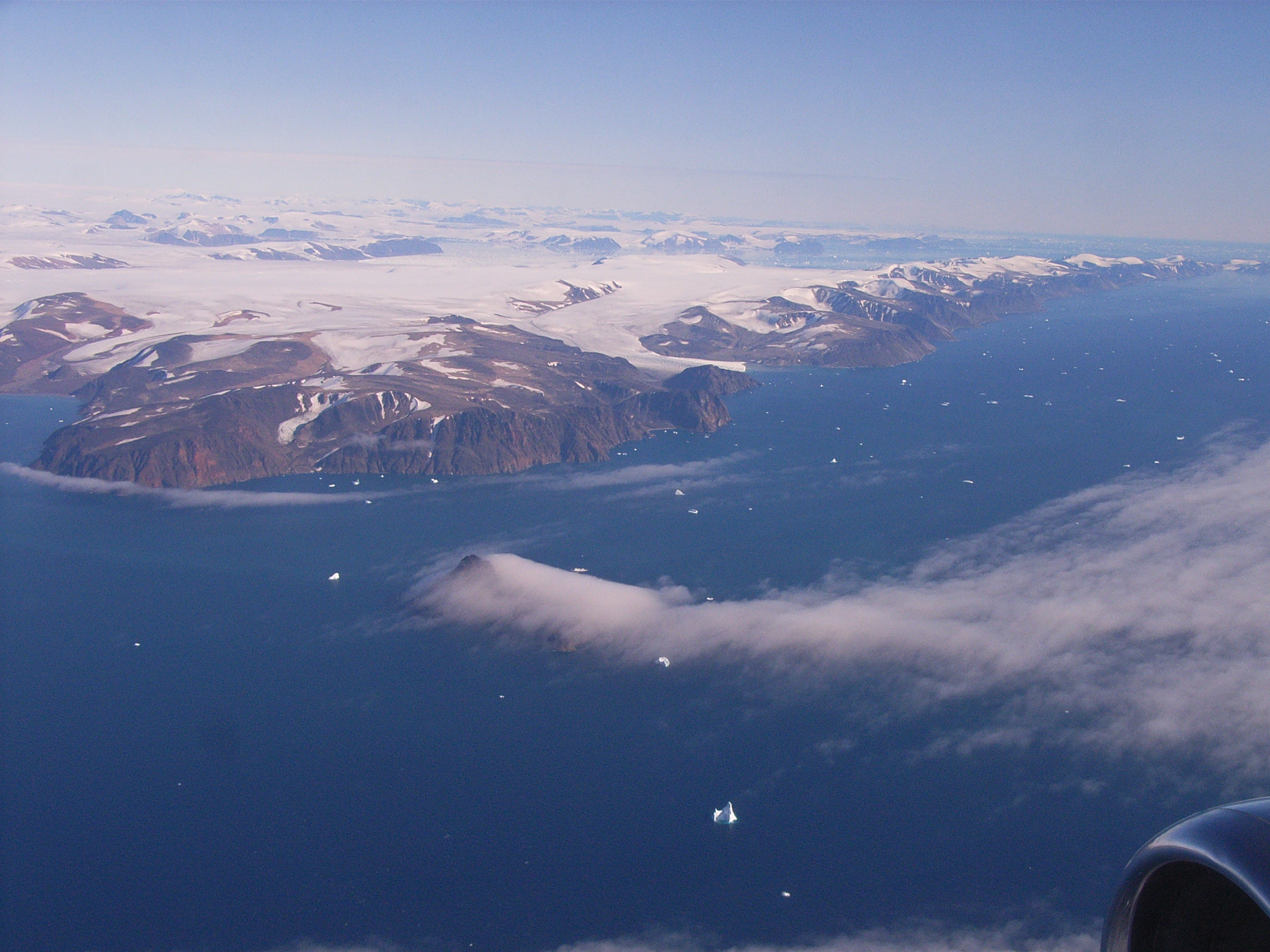
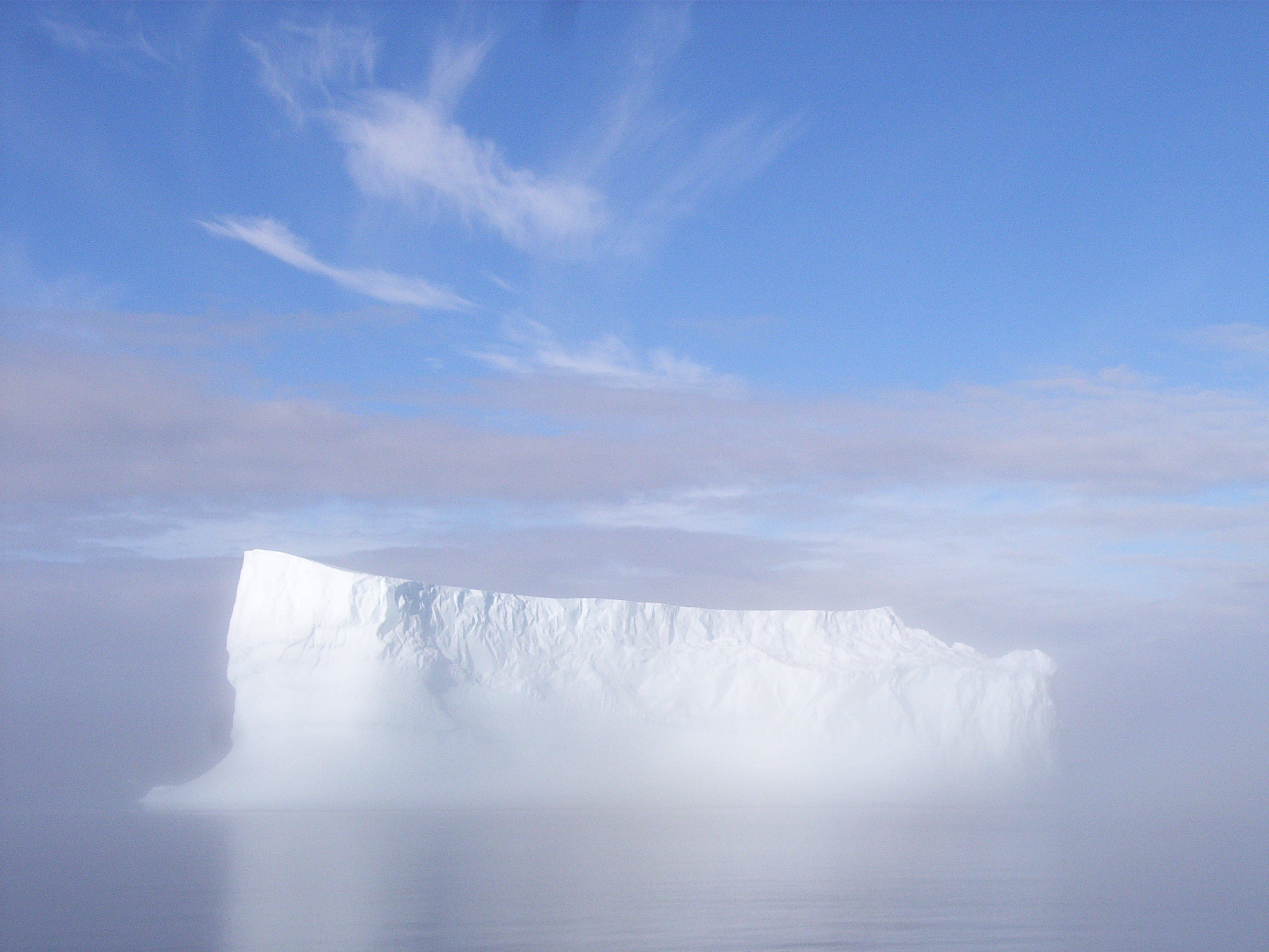
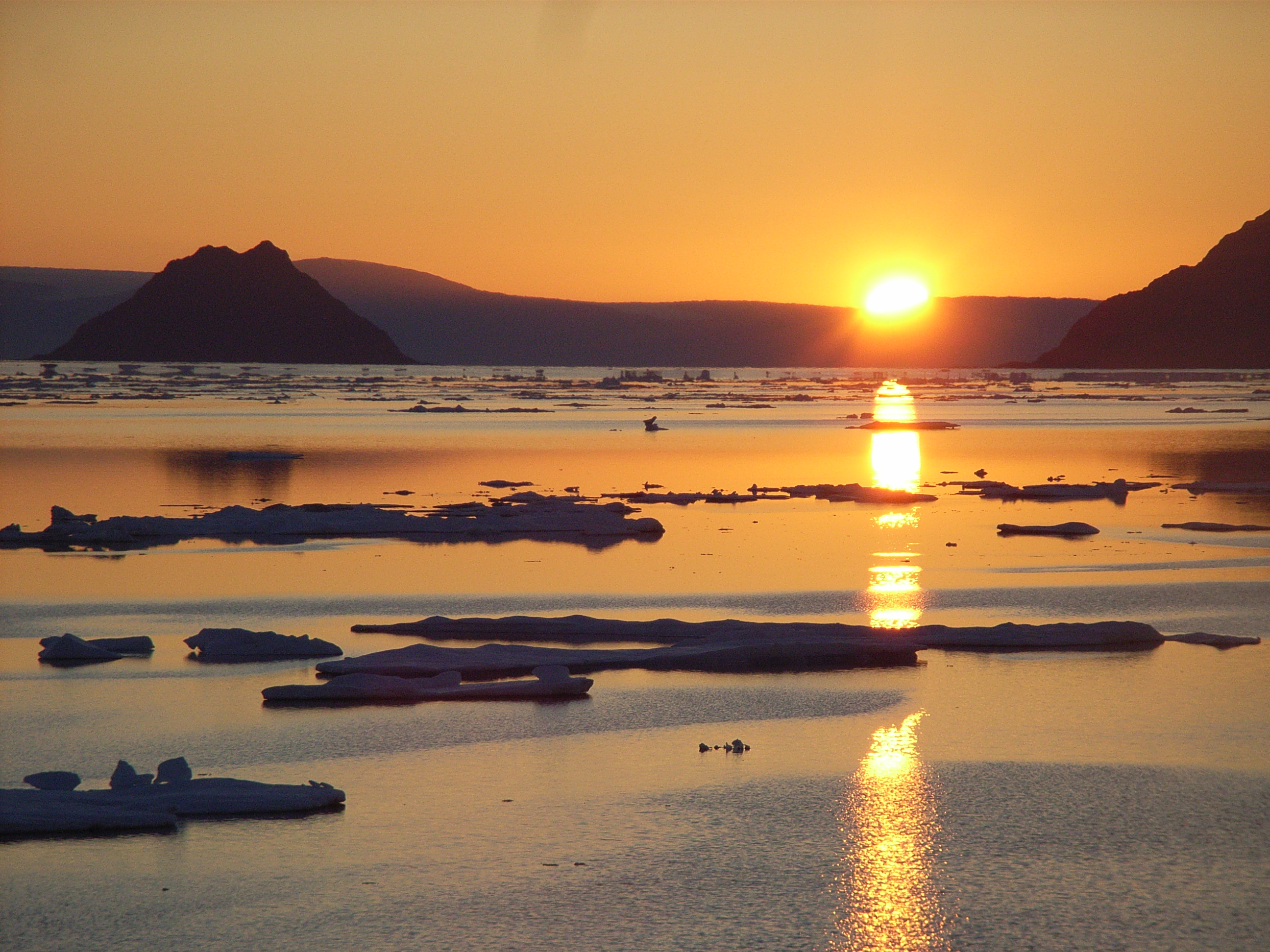
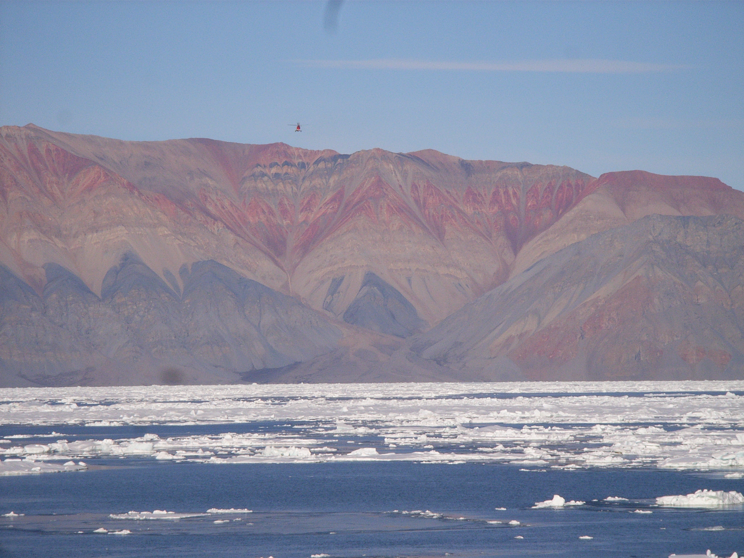
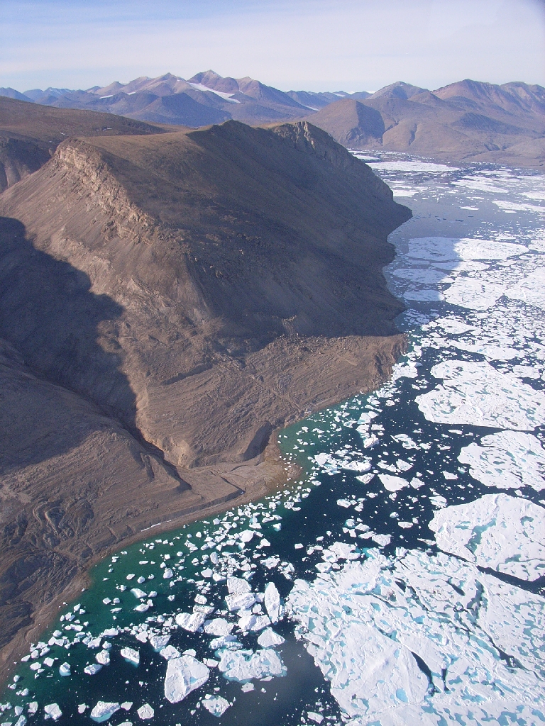
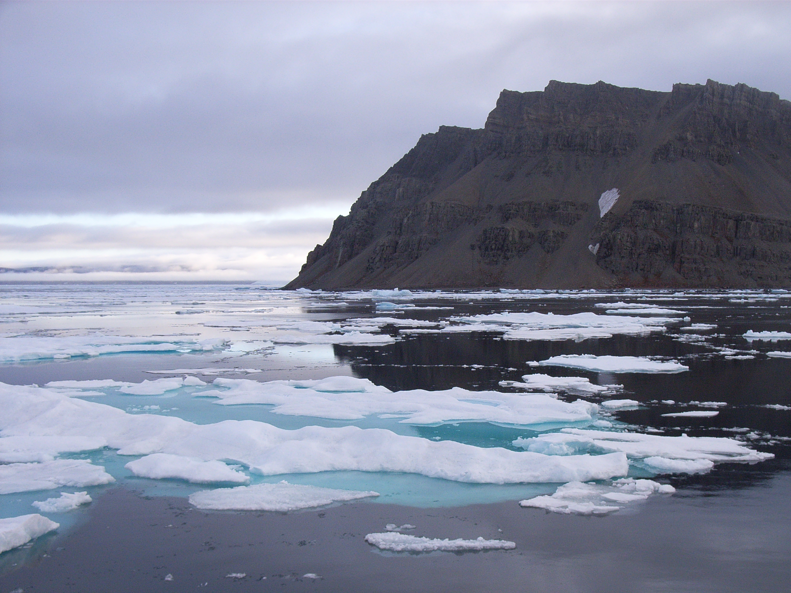
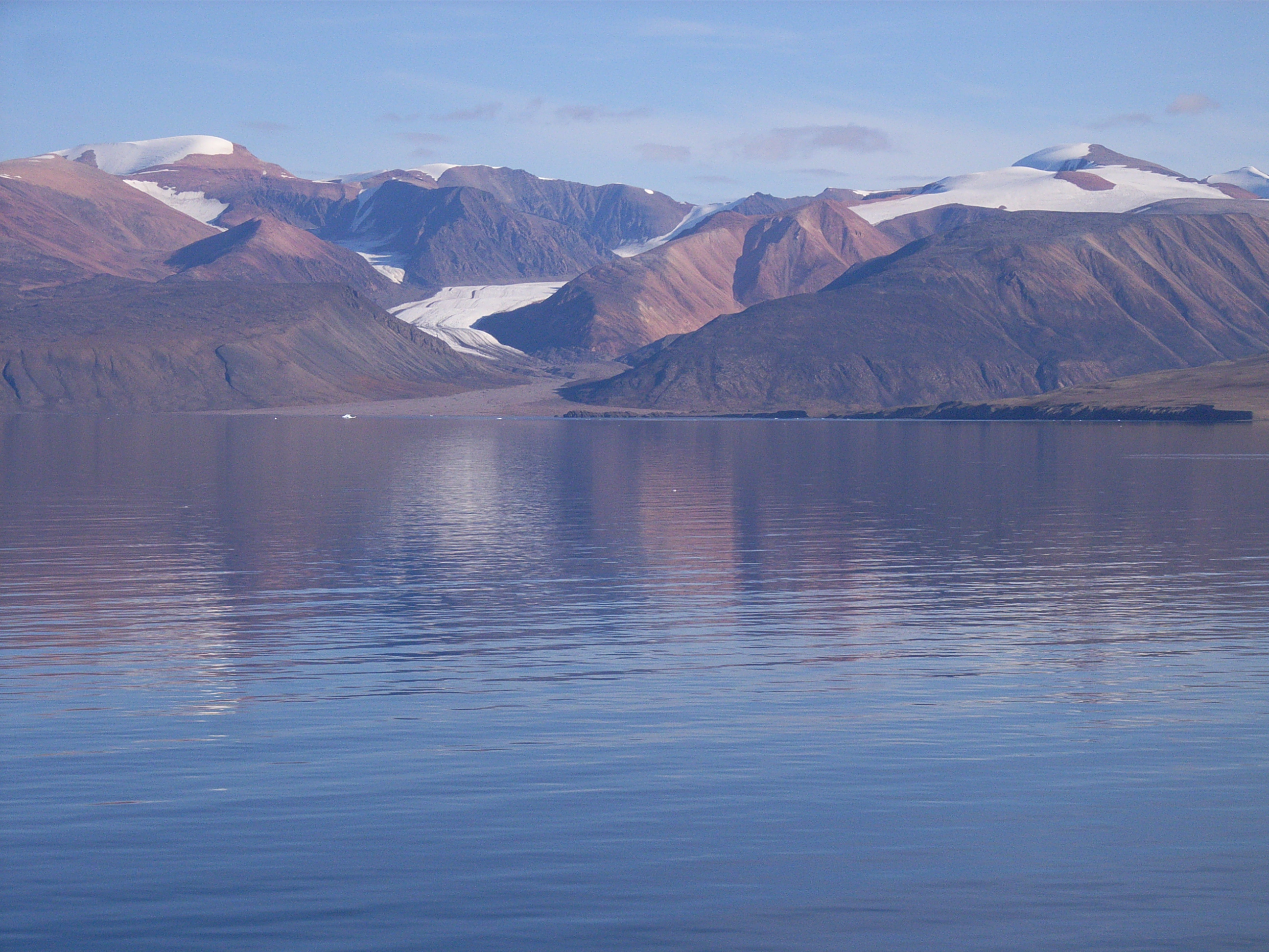
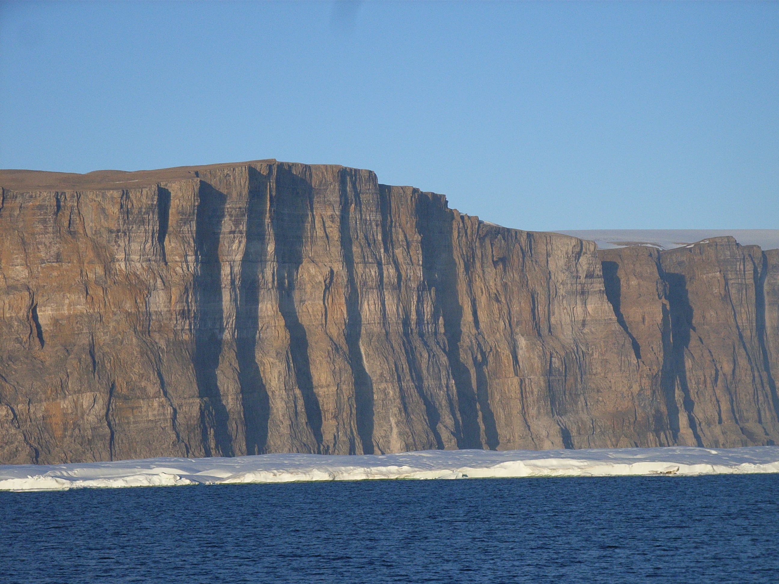 I am definitely one of the luckiest people alive. Not many get a
chance to see the amazing Petermann Fjord, off Hall Basin on the
east side of Nares Strait. Here, the Petermann Glacier reaches the
ocean, and extends for 50 miles or so as a floating ice-tongue in the
fjord. At its grounding line it is more than 600m thick. Fifty miles
downstream (and the bit we're looking at this evening) it is 50m
thick, although of course only a fraction of this is above the water.
On both sides of the fjord huge cliffs drop vertically to the water,
capped by glacial ice. It's stunningly beautiful, and frustratingly
impossible to do justice to with a photograph!
I am definitely one of the luckiest people alive. Not many get a
chance to see the amazing Petermann Fjord, off Hall Basin on the
east side of Nares Strait. Here, the Petermann Glacier reaches the
ocean, and extends for 50 miles or so as a floating ice-tongue in the
fjord. At its grounding line it is more than 600m thick. Fifty miles
downstream (and the bit we're looking at this evening) it is 50m
thick, although of course only a fraction of this is above the water.
On both sides of the fjord huge cliffs drop vertically to the water,
capped by glacial ice. It's stunningly beautiful, and frustratingly
impossible to do justice to with a photograph! 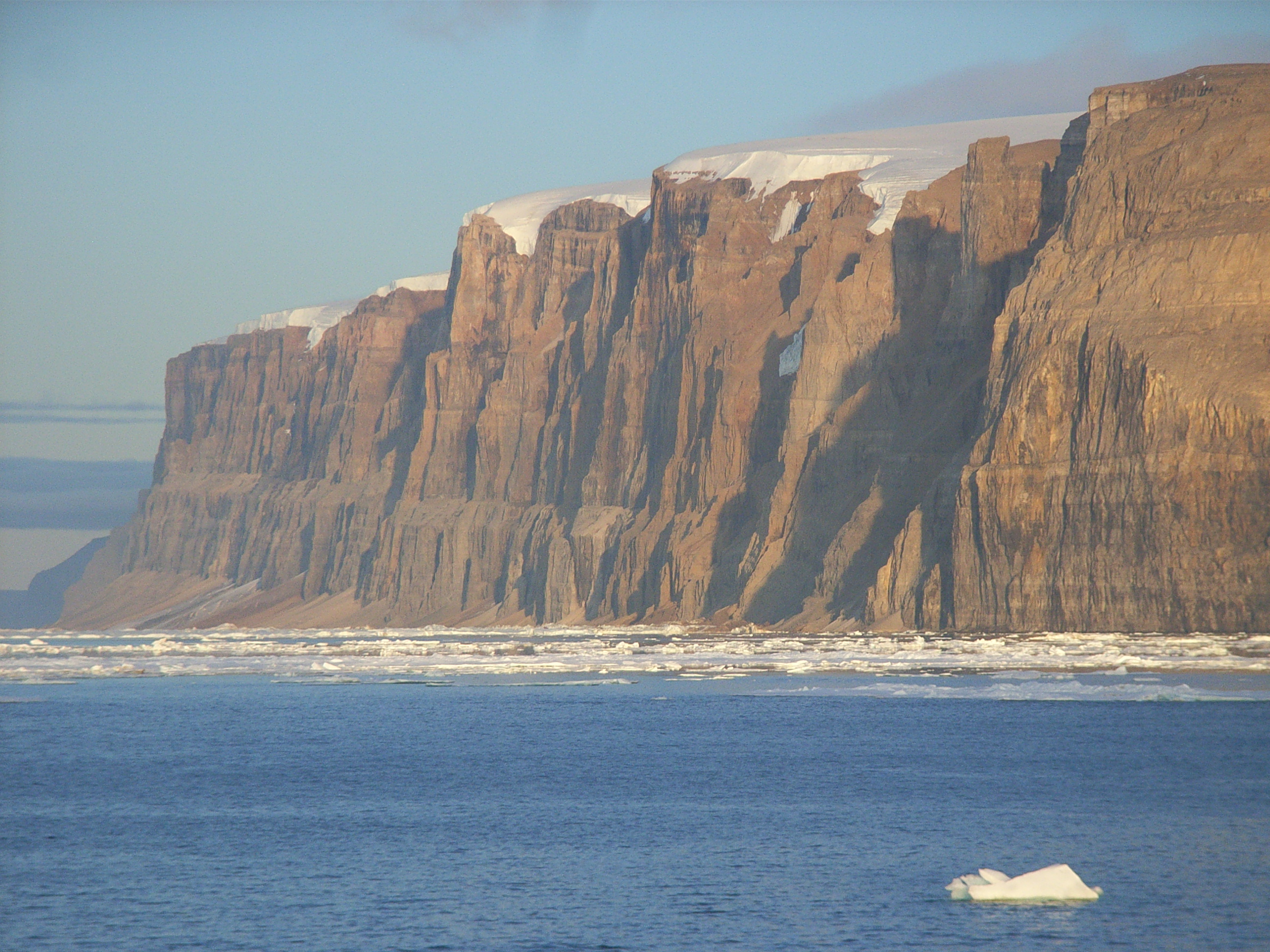 We're in the process of doing a CTD section across the fjord, in the hope of
learning something about what happens to the fresh water that melts from the
glacier. Earlier today, Berit and I had a chance to upload the data from
the CT instruments we recovered yesterday - they seem to have worked
properly, sampling every 15 minutes for the last year, and I'm looking
forward to having a more detailed look at the data. The boys have been busy
too - Dave R has been uploading and checking the data from the IPS, while
Dave S and Ron have been trying to recover two more of the shallow pressure
moorings we deployed in 2003 (at Offley Island and Discovery Harbour). No
luck with either of them, even when they landed by helicopter on the sea-ice
in the bay and tried to communicate with the acoustic release from there!
We're in the process of doing a CTD section across the fjord, in the hope of
learning something about what happens to the fresh water that melts from the
glacier. Earlier today, Berit and I had a chance to upload the data from
the CT instruments we recovered yesterday - they seem to have worked
properly, sampling every 15 minutes for the last year, and I'm looking
forward to having a more detailed look at the data. The boys have been busy
too - Dave R has been uploading and checking the data from the IPS, while
Dave S and Ron have been trying to recover two more of the shallow pressure
moorings we deployed in 2003 (at Offley Island and Discovery Harbour). No
luck with either of them, even when they landed by helicopter on the sea-ice
in the bay and tried to communicate with the acoustic release from there!
 Back on our main mooring line in Kennedy Channel, and another CT mooring on
board first thing this morning! That's four more SBE37 conductivity and
temperature recorders for Berit and I to take care of. Last year we
recovered 29 of these instruments, keeping both of us extremely busy for
well over a week uploading the data and servicing them ready for
re-deployment. We have 8 so far this year, and have made great progress
today getting them ready to go back in the ocean.
Back on our main mooring line in Kennedy Channel, and another CT mooring on
board first thing this morning! That's four more SBE37 conductivity and
temperature recorders for Berit and I to take care of. Last year we
recovered 29 of these instruments, keeping both of us extremely busy for
well over a week uploading the data and servicing them ready for
re-deployment. We have 8 so far this year, and have made great progress
today getting them ready to go back in the ocean.
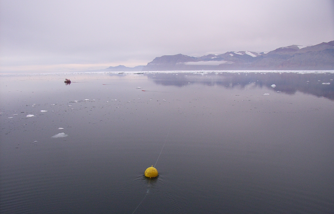
 Arctic oceanography certainly requires great patience! We spent this
morning trying to sneak up on an IPS mooring deployed last year on the
western side of the channel. The ice over there is still very heavy, so we
located a patch of open water upstream and settled down to wait for it (and
us) to drift south at about 1 m/s over the mooring site. We know exactly
where the mooring is from our acoustic ranges, and things were looking great
for a recovery. Three hours later though, the size (and shape) of our patch
had changed a lot, and the mooring passed by to the side of us -
frustratingly still under the ice!
Arctic oceanography certainly requires great patience! We spent this
morning trying to sneak up on an IPS mooring deployed last year on the
western side of the channel. The ice over there is still very heavy, so we
located a patch of open water upstream and settled down to wait for it (and
us) to drift south at about 1 m/s over the mooring site. We know exactly
where the mooring is from our acoustic ranges, and things were looking great
for a recovery. Three hours later though, the size (and shape) of our patch
had changed a lot, and the mooring passed by to the side of us -
frustratingly still under the ice!
 The ADCP moorings are what we call "torsionally rigid", which means they
have a special joint holding them to their anchors which allows them to bend
over in all directions but not to rotate. That's because we need them to
have the same orientation throughout their deployment - when we get them
back we can work out how they were sat on the bottom (and hence the
direction of the currents in the profile) from the tidal direction in the
data. We can't use a compass for accurate monitoring of direction in the
instruments up here because they're so close to the magnetic north pole that
the horizontal component of the Earth's magnetic field is quite weak.
(Humfrey's group at the Institute of Ocean Sciences have been using the
torsionally-rigid approach successfully elsewhere in the Canadian
Archipelago for many years. Just one of many challenges they've had to
overcome to collect reliable data up here!) The ADCP moorings have become
known as "lollipops" by the crew this year because of their shape :-)
The ADCP moorings are what we call "torsionally rigid", which means they
have a special joint holding them to their anchors which allows them to bend
over in all directions but not to rotate. That's because we need them to
have the same orientation throughout their deployment - when we get them
back we can work out how they were sat on the bottom (and hence the
direction of the currents in the profile) from the tidal direction in the
data. We can't use a compass for accurate monitoring of direction in the
instruments up here because they're so close to the magnetic north pole that
the horizontal component of the Earth's magnetic field is quite weak.
(Humfrey's group at the Institute of Ocean Sciences have been using the
torsionally-rigid approach successfully elsewhere in the Canadian
Archipelago for many years. Just one of many challenges they've had to
overcome to collect reliable data up here!) The ADCP moorings have become
known as "lollipops" by the crew this year because of their shape :-)
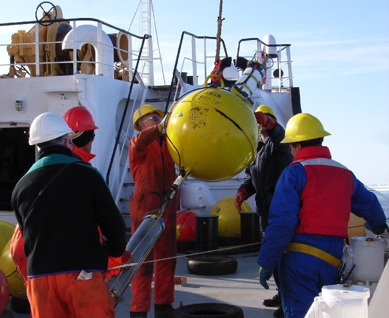
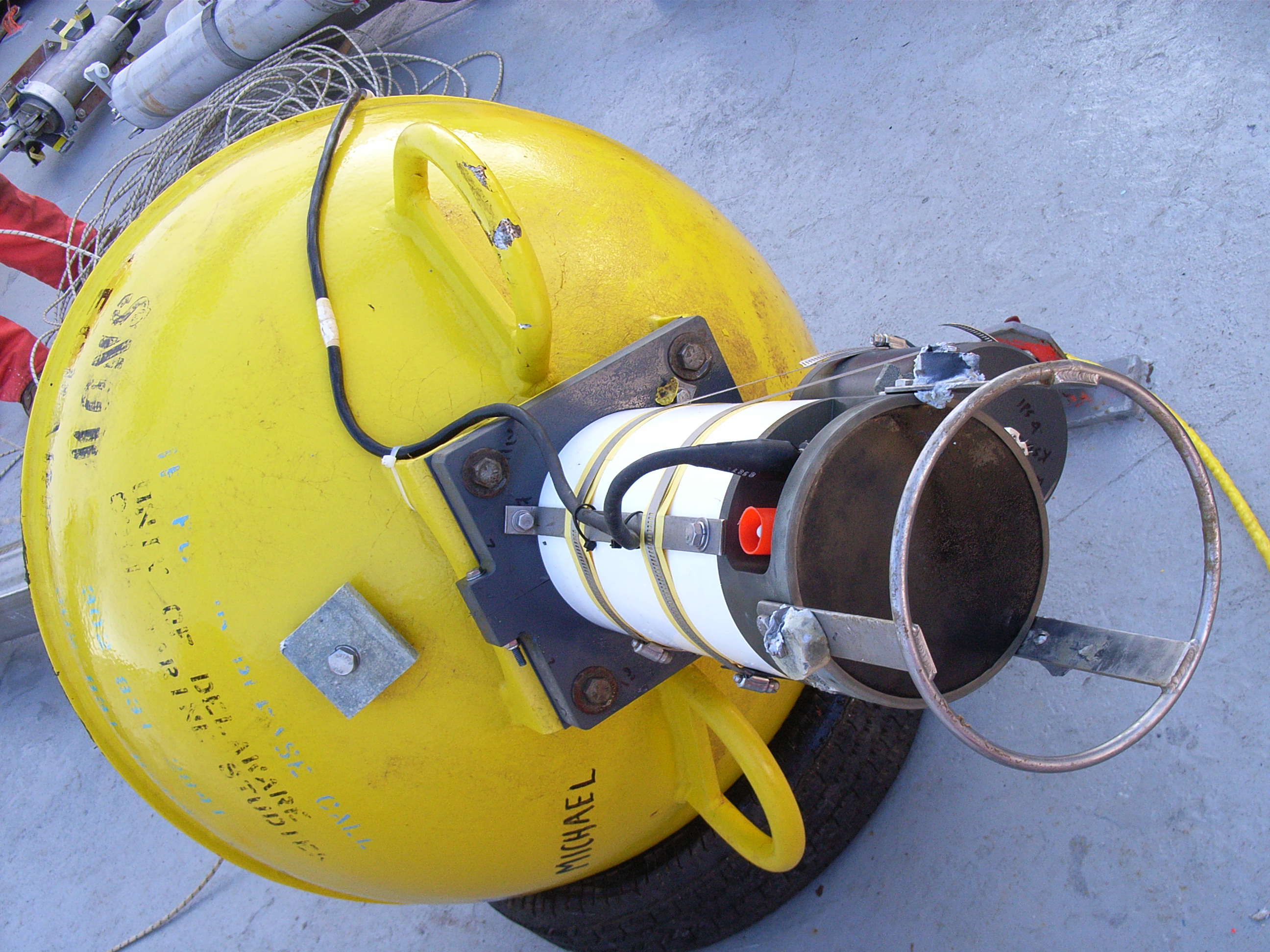
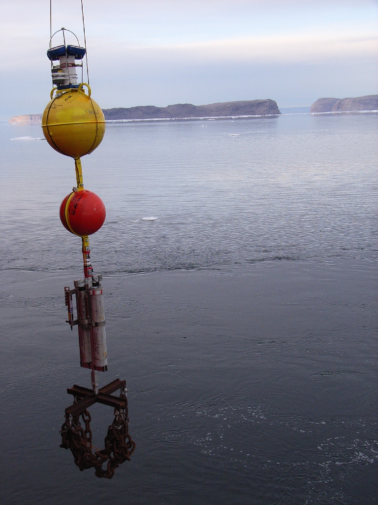
 More mooring deployments today. We started with an ADCP "lollipop"
mooring, and then moved on to a couple of the CT strings. We use the
FRC for the CT strings - Howard (who drives the FRC with one of the
deck crew to help) takes the top of the mooring away from the ship,
keeping it taught and tangle free as we pay out the line from the
foredeck. We lift the final portion of the mooring (yellow float,
acoustic release and a pile of old chain that serves as an anchor)
over the ship's rail using the crane, instruct Howard to let go of his
end, and then drop the anchor. The floating components of the mooring
come whizzing along the surface before submerging - it's fun to watch
(although with so much ice around we are all holding our breath that
the mooring makes it down without damage!)
More mooring deployments today. We started with an ADCP "lollipop"
mooring, and then moved on to a couple of the CT strings. We use the
FRC for the CT strings - Howard (who drives the FRC with one of the
deck crew to help) takes the top of the mooring away from the ship,
keeping it taught and tangle free as we pay out the line from the
foredeck. We lift the final portion of the mooring (yellow float,
acoustic release and a pile of old chain that serves as an anchor)
over the ship's rail using the crane, instruct Howard to let go of his
end, and then drop the anchor. The floating components of the mooring
come whizzing along the surface before submerging - it's fun to watch
(although with so much ice around we are all holding our breath that
the mooring makes it down without damage!)
|
|
|
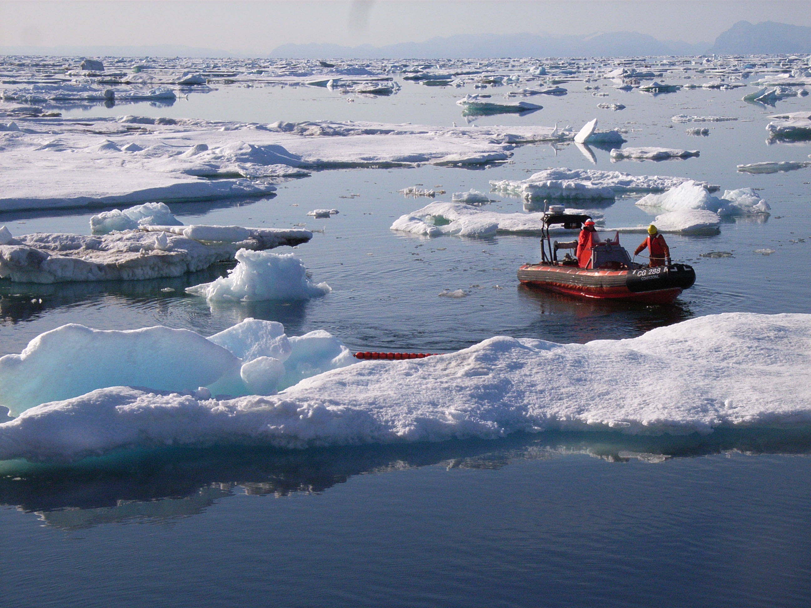
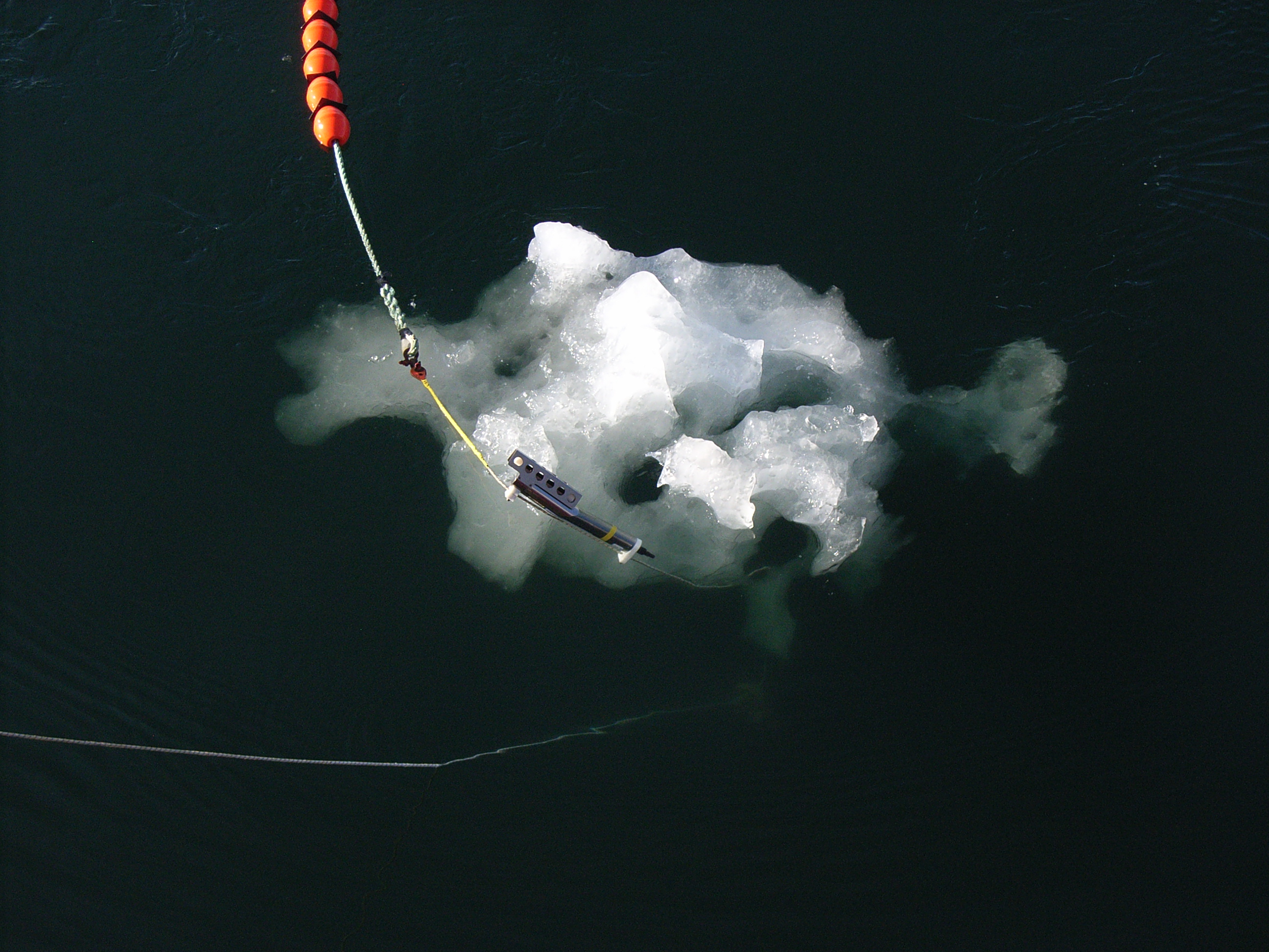
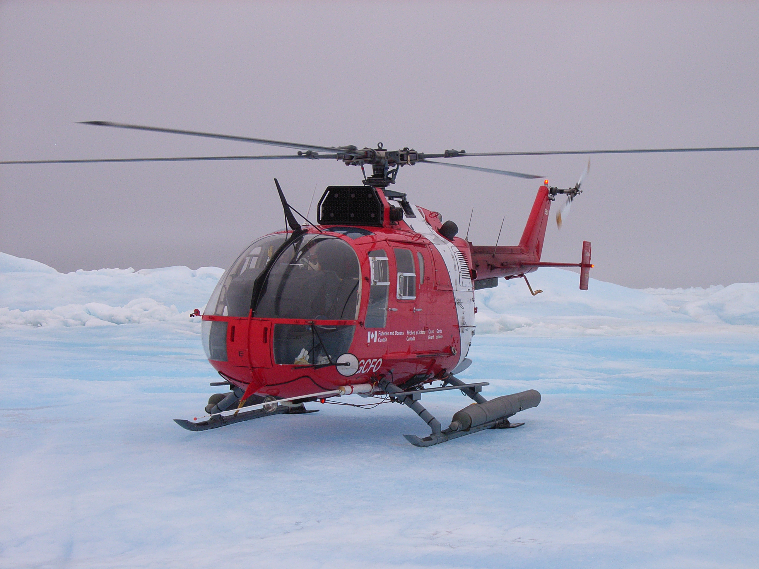
 As we passed by Foulke Fjord this afternoon, I had another chance to
try retrieving the shallow pressure mooring there (after failing to
communicate with it from the FRC on the way north two weeks ago). Jo
and I flew in by helicopter, landing on the little promontory on the
southern side of the fjord, and deployed our hydrophone in shallow
water from the beach. We immediately managed to communicate with the
acoustic release, which was where we had left it last year in 20m of
water about 40-50m out from the beach. We sent a release command and
waited with baited breath - the command was received by the acoustic
release, but nothing popped up to the surface :( We took off in the
helicopter to fly over the fjord and check that we hadn't missed it,
but saw nothing. Disappointed, we headed back to the ship (via a
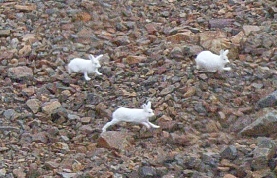
circuitous route over the mountains nearby, where we saw more arctic
hare, the remains of the old settlement Etah, and two local hunters
carrying recently killed musk ox meat down to their small boats in the
cove!). Dave Spear and I then returned to Foulke Fjord in the FRC
with Howard and crew member Izzy to try dragging for the mooring - the
most likely scenario is that the float which is supposed to pop to the
surface when the release mechanism operates is stuck or tangled
somehow, and we need to snag it with a grappling hook to bring it up.
We had several attempts at this, but no luck, and eventually the fog
rolled in forcing us to abandon our efforts and head back to the ship.
So frustrating to be able to hear the acoustic release chirping his
five "I've released come and get me" pings (even without any
transducer in the water because we were so close and the mooring so
shallow!) yet not be able to retrieve him....
As we passed by Foulke Fjord this afternoon, I had another chance to
try retrieving the shallow pressure mooring there (after failing to
communicate with it from the FRC on the way north two weeks ago). Jo
and I flew in by helicopter, landing on the little promontory on the
southern side of the fjord, and deployed our hydrophone in shallow
water from the beach. We immediately managed to communicate with the
acoustic release, which was where we had left it last year in 20m of
water about 40-50m out from the beach. We sent a release command and
waited with baited breath - the command was received by the acoustic
release, but nothing popped up to the surface :( We took off in the
helicopter to fly over the fjord and check that we hadn't missed it,
but saw nothing. Disappointed, we headed back to the ship (via a
circuitous route over the mountains nearby, where we saw more arctic
hare, the remains of the old settlement Etah, and two local hunters
carrying recently killed musk ox meat down to their small boats in the
cove!). Dave Spear and I then returned to Foulke Fjord in the FRC
with Howard and crew member Izzy to try dragging for the mooring - the
most likely scenario is that the float which is supposed to pop to the
surface when the release mechanism operates is stuck or tangled
somehow, and we need to snag it with a grappling hook to bring it up.
We had several attempts at this, but no luck, and eventually the fog
rolled in forcing us to abandon our efforts and head back to the ship.
So frustrating to be able to hear the acoustic release chirping his
five "I've released come and get me" pings (even without any
transducer in the water because we were so close and the mooring so
shallow!) yet not be able to retrieve him.... 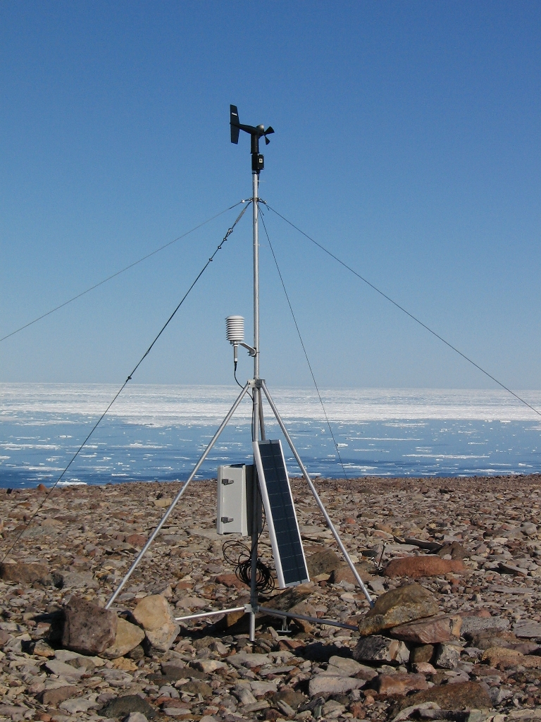 Amidst grey skies, 20 knots of wind, and patches of fog, we returned
to the Met stations to reinstall the data-loggers. Hardly the
sunshine and calm conditions of our original trip to collect them, but
reasonable working conditions nonetheless. At Pim Island, the station
required very little mechanical work - just some tightening of the
guy-wires. The big change to both the stations on this trip was the
installation of an additional battery which should enable the station
to operate through the dark of winter (the second battery triples the
original number of amp-hours). Thanks to Israel "Izzy" Strickland for
his custom-made Canadian Coast Guard, red-with-white-stripe, wooden
boxes that will protect the extra batteries from wind and
precipitation. After reconnecting the control box to the sensors, we
connected the logger to a laptop to confirm that everything was
operating correctly. Pressure, air temperature, relative humidity,
wind speed, and wind direction all checked out. Dave Spear then
established a rough heading with a handheld GPS unit corresponding to
the station vane's direction which enabled us to confirm that the
orientation of the mast was correct.
Amidst grey skies, 20 knots of wind, and patches of fog, we returned
to the Met stations to reinstall the data-loggers. Hardly the
sunshine and calm conditions of our original trip to collect them, but
reasonable working conditions nonetheless. At Pim Island, the station
required very little mechanical work - just some tightening of the
guy-wires. The big change to both the stations on this trip was the
installation of an additional battery which should enable the station
to operate through the dark of winter (the second battery triples the
original number of amp-hours). Thanks to Israel "Izzy" Strickland for
his custom-made Canadian Coast Guard, red-with-white-stripe, wooden
boxes that will protect the extra batteries from wind and
precipitation. After reconnecting the control box to the sensors, we
connected the logger to a laptop to confirm that everything was
operating correctly. Pressure, air temperature, relative humidity,
wind speed, and wind direction all checked out. Dave Spear then
established a rough heading with a handheld GPS unit corresponding to
the station vane's direction which enabled us to confirm that the
orientation of the mast was correct. 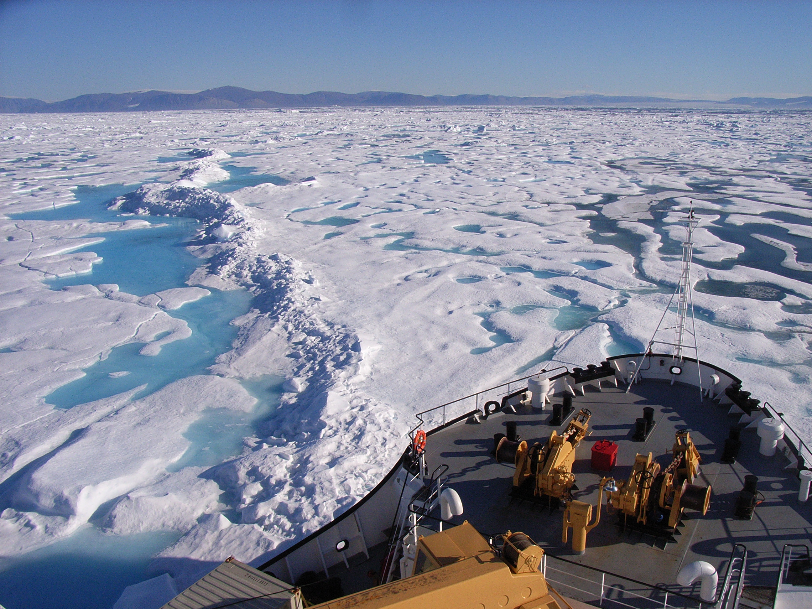 The average thickness of Arctic multi-year ice is about 3-4 m, a value
that conceals appreciable regional disparity. The circulation of ice
within the Arctic Ocean results in a general movement of ice away from
Siberia and an accumulation of the oldest and thickest ice against
northern Greenland and the Canadian Archipelago. A few transects by
submarine sonar more than 30 years ago measured average ice draft of
5-8 m (add 15% to get thickness in rough ice) in these areas. It is
these reservoirs that feed the stream of ice through the straits of
the Canadian High Arctic. Since our new data are not dramatically
inconsistent with those from years long past, we tentatively conclude
that the Canadian side of the Arctic remains capable in 2007 of
nurturing multi-year floes as thick as have ever been observed. A
careful look at the maps of the shrinking perennial Arctic pack
reveals that the primary area of loss has been on the other side of
the Arctic, eastward along the Eurasian coast from the Kara Sea to the
western Beaufort.
The average thickness of Arctic multi-year ice is about 3-4 m, a value
that conceals appreciable regional disparity. The circulation of ice
within the Arctic Ocean results in a general movement of ice away from
Siberia and an accumulation of the oldest and thickest ice against
northern Greenland and the Canadian Archipelago. A few transects by
submarine sonar more than 30 years ago measured average ice draft of
5-8 m (add 15% to get thickness in rough ice) in these areas. It is
these reservoirs that feed the stream of ice through the straits of
the Canadian High Arctic. Since our new data are not dramatically
inconsistent with those from years long past, we tentatively conclude
that the Canadian side of the Arctic remains capable in 2007 of
nurturing multi-year floes as thick as have ever been observed. A
careful look at the maps of the shrinking perennial Arctic pack
reveals that the primary area of loss has been on the other side of
the Arctic, eastward along the Eurasian coast from the Kara Sea to the
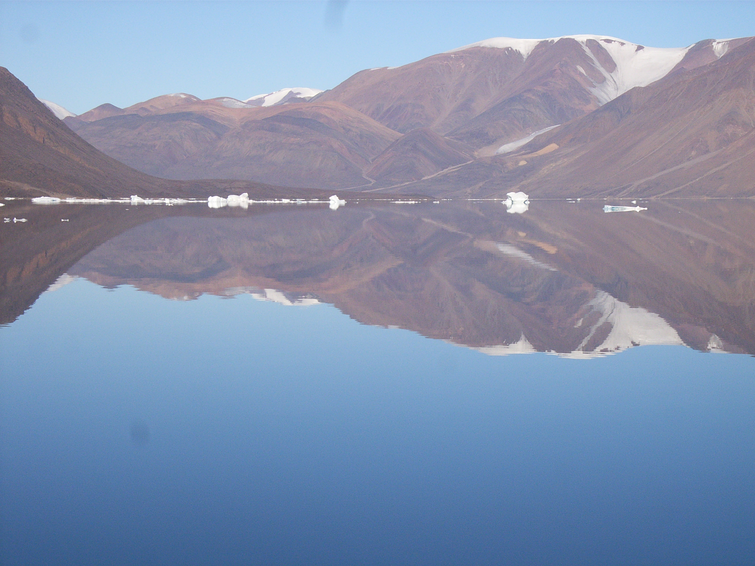
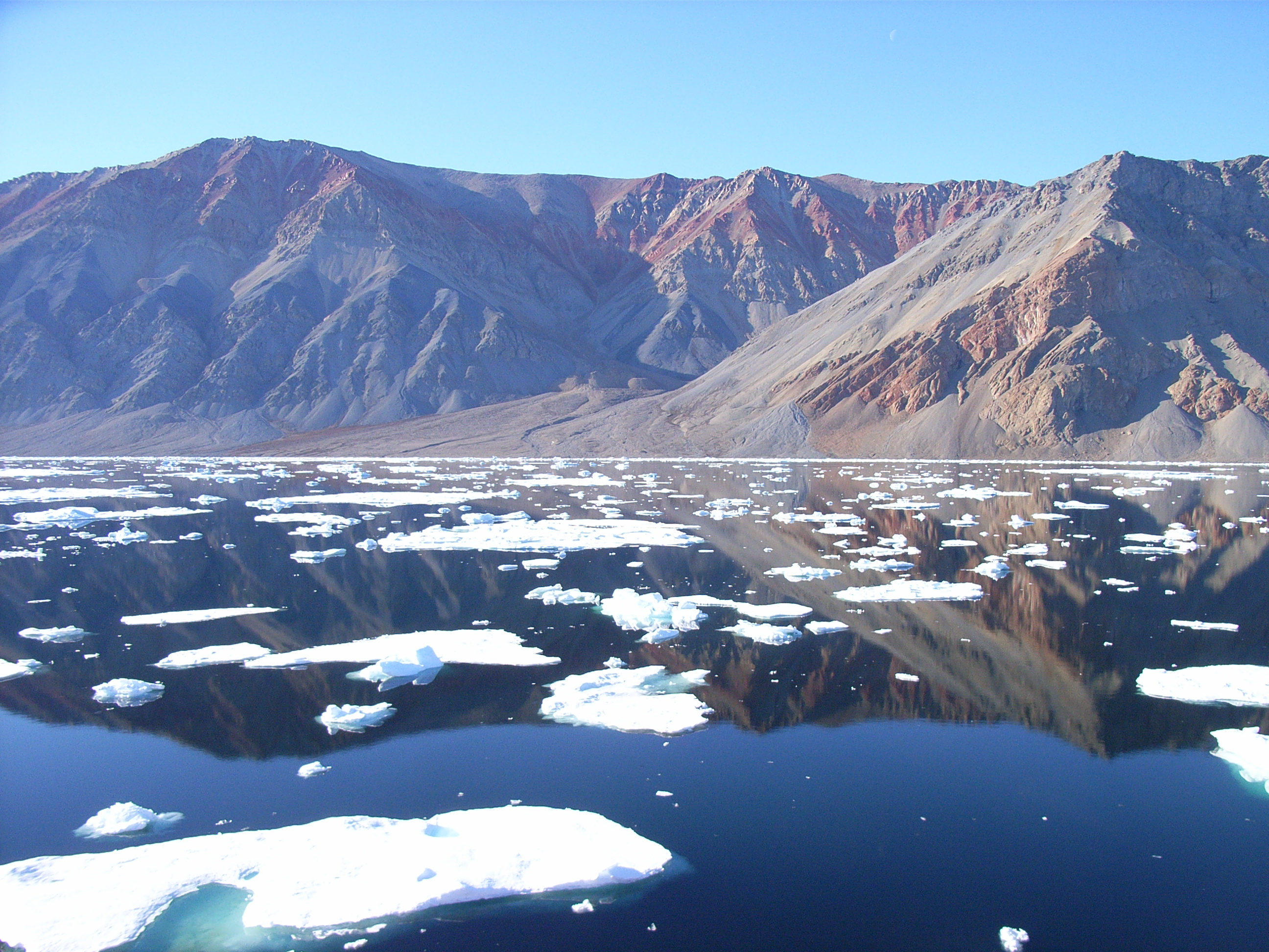
western Beaufort. 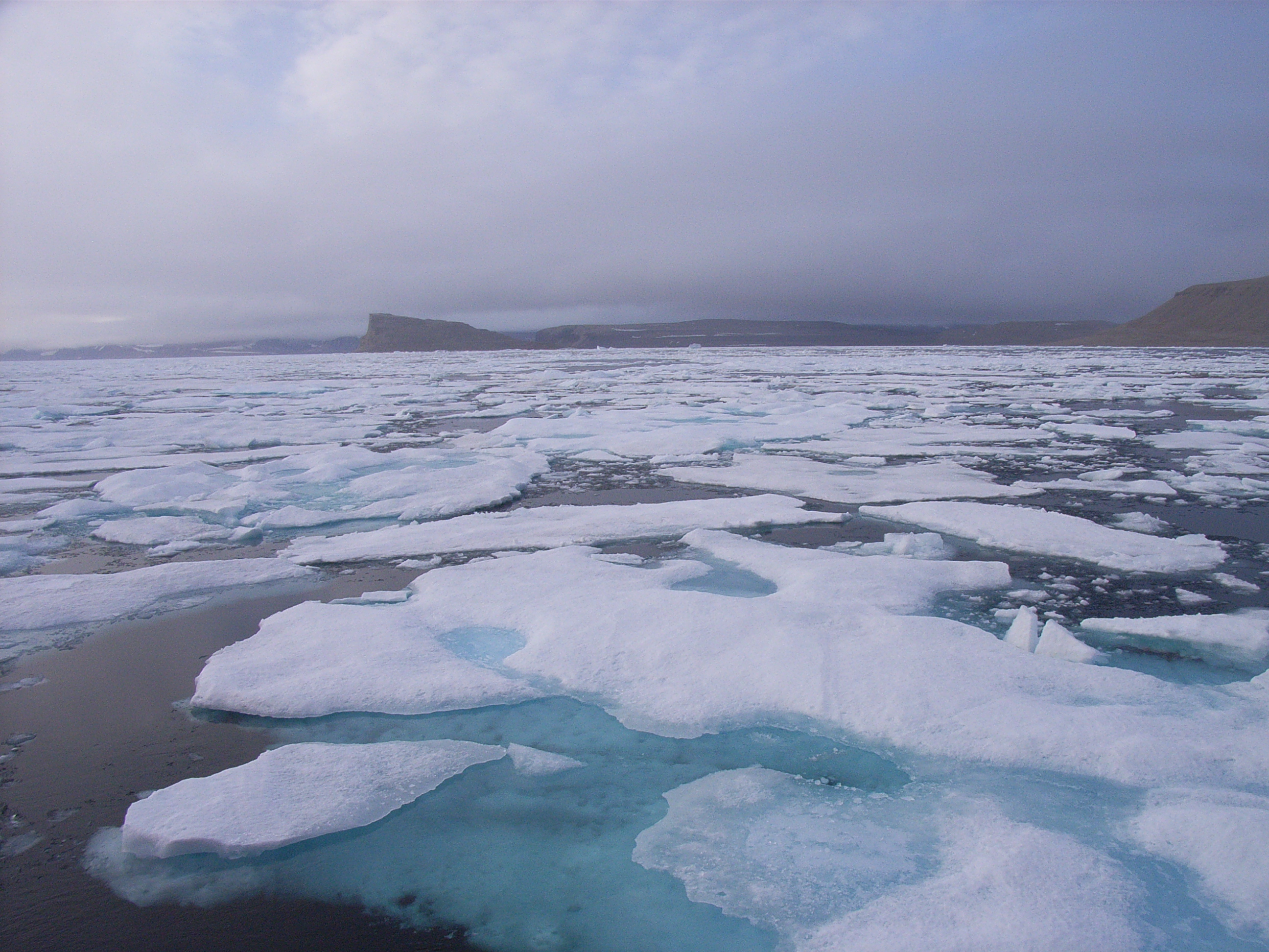 We're in Cardigan Strait today, an 8km wide channel between North Kent
Island and Devon Island in the heart of the Canadian Archipelago.
It's a beautiful spot, although right now we can't see anything at all
because of the fog! When we arrived at the southern end of the strait
via Fram Sound last night the sky was spectacular - we're far enough
south and late enough in the year now for the sun to actually set,
which makes for some amazing colours :-)
We're in Cardigan Strait today, an 8km wide channel between North Kent
Island and Devon Island in the heart of the Canadian Archipelago.
It's a beautiful spot, although right now we can't see anything at all
because of the fog! When we arrived at the southern end of the strait
via Fram Sound last night the sky was spectacular - we're far enough
south and late enough in the year now for the sun to actually set,
which makes for some amazing colours :-)  In effect, MOTAN uses the ship's response to back calculate the forces
that would have been required to produce the measured ship motions in
six degrees of freedom. We have installed MOTAN on five ice
strengthened ships since its first installation on the USCGC Healy in
the year 2000. MOTAN is recording data 24 hours a day, so there will
be a huge amount of data to sort through by the time we finish these
field trials in early September. To help with that process, we have
installed a small, hand held device to identify the most significant
impacts from where we stand on the bridge. Whenever the ice impact
causes the ship to respond in a `lively manner' (appreciable movement
in pitch, roll or sway for example), I push the button on the hand
held box. That sends a signal to MOTAN telling it that a noteworthy
impact occurred. Those type of `event markers' will make it much
easier to process the data at the end of the trip.
In effect, MOTAN uses the ship's response to back calculate the forces
that would have been required to produce the measured ship motions in
six degrees of freedom. We have installed MOTAN on five ice
strengthened ships since its first installation on the USCGC Healy in
the year 2000. MOTAN is recording data 24 hours a day, so there will
be a huge amount of data to sort through by the time we finish these
field trials in early September. To help with that process, we have
installed a small, hand held device to identify the most significant
impacts from where we stand on the bridge. Whenever the ice impact
causes the ship to respond in a `lively manner' (appreciable movement
in pitch, roll or sway for example), I push the button on the hand
held box. That sends a signal to MOTAN telling it that a noteworthy
impact occurred. Those type of `event markers' will make it much
easier to process the data at the end of the trip. 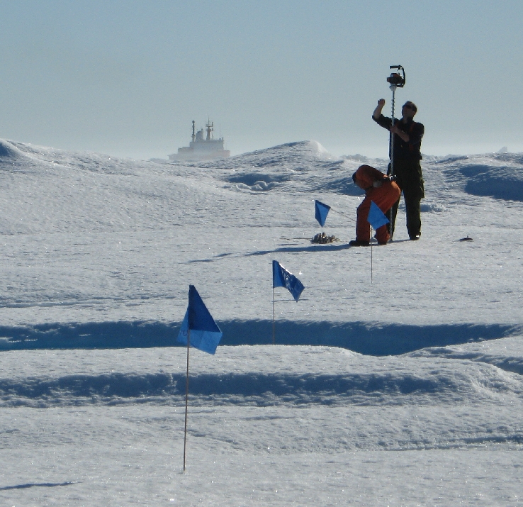 So far, we have visited 9 multi-year floes and drilled more than 1200
m. We are comparing the ice thickness that we measure from drill
holes to measurements from two ground conductivity meters, each with a
different operating frequency and, therefore, different penetration
depths. The advantage of using instruments like the ground
conductivity meter, which uses the electromagnetic induction
technique, is that these types of instruments operate from the ice
surface. If either of these instruments is proven to give reliable
results during this study, it would eliminate the need to drill holes
through the ice, which is very labor intensive (just ask Richard!).
So far, we have visited 9 multi-year floes and drilled more than 1200
m. We are comparing the ice thickness that we measure from drill
holes to measurements from two ground conductivity meters, each with a
different operating frequency and, therefore, different penetration
depths. The advantage of using instruments like the ground
conductivity meter, which uses the electromagnetic induction
technique, is that these types of instruments operate from the ice
surface. If either of these instruments is proven to give reliable
results during this study, it would eliminate the need to drill holes
through the ice, which is very labor intensive (just ask Richard!).
 We deployed our final two ADCP moorings today in Cardigan Strait - it's a
good feeling to have everything off the deck and in the water. Dave S and
Ron also went out in the FRC to have a go at recovering the mooring on the
western side of the channel that we failed to communicate with on Tuesday.
The idea was to get away from the background noise generated by the ship,
but they still had no response from either of the acoustic releases. We
have to resign ourselves to the fact that we're not going to get this
particular mooring back...
We deployed our final two ADCP moorings today in Cardigan Strait - it's a
good feeling to have everything off the deck and in the water. Dave S and
Ron also went out in the FRC to have a go at recovering the mooring on the
western side of the channel that we failed to communicate with on Tuesday.
The idea was to get away from the background noise generated by the ship,
but they still had no response from either of the acoustic releases. We
have to resign ourselves to the fact that we're not going to get this
particular mooring back...
 We saw some amazing clouds yesterday evening, streaming down off the cliffs
at the entrance to Hell Gate (perhaps generated by hydraulic effects?).
These were just the latest in a series of amazing skies and interesting
meteorological phenomena we've seen this trip!
We saw some amazing clouds yesterday evening, streaming down off the cliffs
at the entrance to Hell Gate (perhaps generated by hydraulic effects?).
These were just the latest in a series of amazing skies and interesting
meteorological phenomena we've seen this trip!
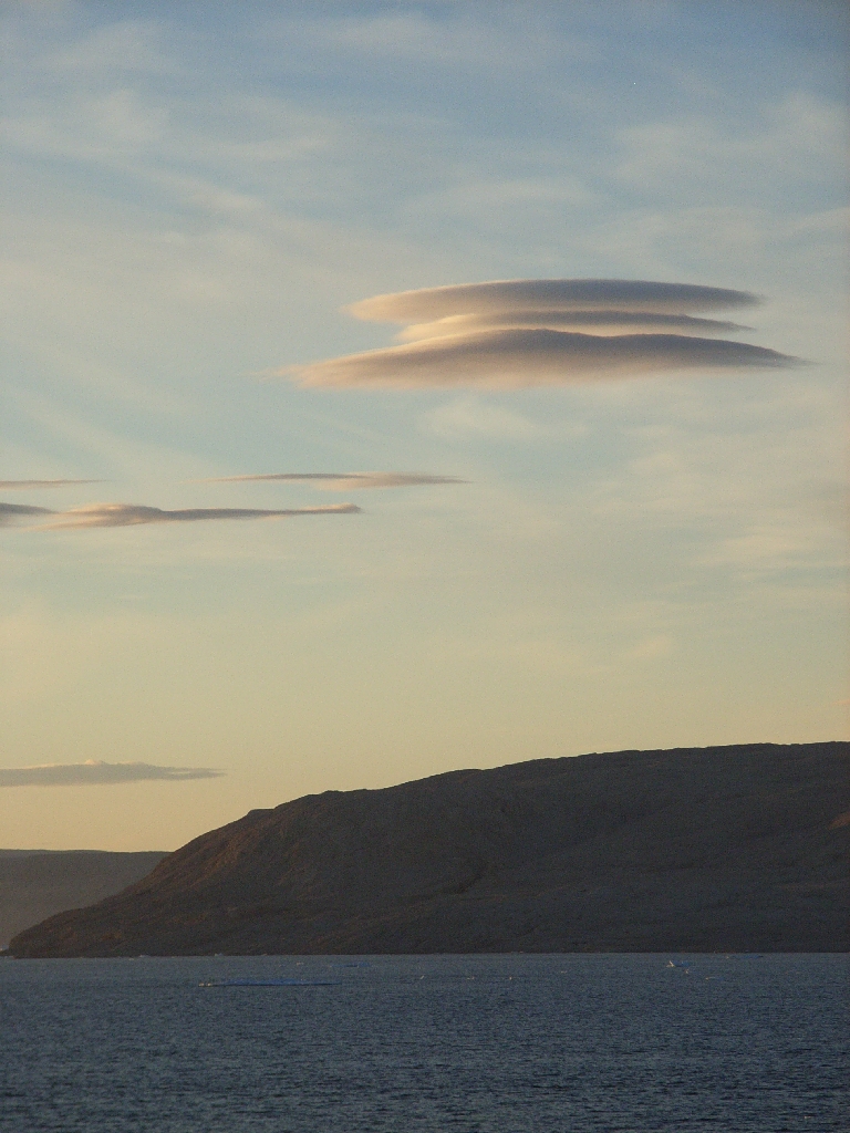 the air in the cloud-free layer above is moving faster than the cloudy air
below (what's known as shear instability). They don't seem to last for
long, and are frustratingly difficult to photograph, but I'll try to post a
picture when I get home. The same low layer of cloud also leads to surreal
views of the mountains (particularly on the Ellesmere side) which often poke
out from a white blanket!
the air in the cloud-free layer above is moving faster than the cloudy air
below (what's known as shear instability). They don't seem to last for
long, and are frustratingly difficult to photograph, but I'll try to post a
picture when I get home. The same low layer of cloud also leads to surreal
views of the mountains (particularly on the Ellesmere side) which often poke
out from a white blanket!
|
|
 It will take us all some time to get home - most of the science team will
leave the ship in the morning, and spend tomorrow night in Pond Inlet before
flying south to Iqaluit, the capital of Nunavut, on Tuesday. From there
some will head to Ottawa en route to Delaware and British Columbia, whilst
I'll fly to Montreal on Wednesday (with Humfrey for company) to catch an
international flight back home. Hopefully I'll make it to London early on
Friday morning. For the coastguard crew there's still lots of work to be
done before they finish their shift on 19 September. Tomorrow the Larsen
will head to Nanisivik to take on fuel and will then escort various cruise
ships through icy waters on her way south to Iqaluit.
It will take us all some time to get home - most of the science team will
leave the ship in the morning, and spend tomorrow night in Pond Inlet before
flying south to Iqaluit, the capital of Nunavut, on Tuesday. From there
some will head to Ottawa en route to Delaware and British Columbia, whilst
I'll fly to Montreal on Wednesday (with Humfrey for company) to catch an
international flight back home. Hopefully I'll make it to London early on
Friday morning. For the coastguard crew there's still lots of work to be
done before they finish their shift on 19 September. Tomorrow the Larsen
will head to Nanisivik to take on fuel and will then escort various cruise
ships through icy waters on her way south to Iqaluit.
|
|
|
|