

|
This tutorial will guide you through the basic steps in the creation of the forest resource maps that are needed in a management plan. The tutorial uses a woodland at Little Wittenham in Oxfordshire as a case study. The wood is part of Little Wittenham Nature Reserve, owned and managed by the Northmoor Trust. |
 |
1. Preparing a base mapTutorial: An introduction to digital mapping – managing layers and displaying labels. Practical: Open an OS Land-Line.Plus tile. Open English Nature Ancient Woodland and SSSI map layers. Produce a simple labelled boundary map of Little Wittenham Wood.
|
|
|
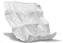
2. Using data from paper mapsTutorial: Vector and raster images. Scanning and digitising. Practical: Register a raster image of the Little Wittenham compartment map.
|
|
 |
3. Linking a database to a mapFieldwork: Collect information on the species and planting date of all compartments in Little Wittenham wood. Practical: Open a raster image of a scanned map and trace compartment boundaries. Link each compartment to field data stored in an Excel spreadsheet.
|
|
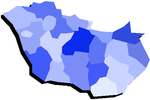 |
4. Adding attribute data to create a thematic mapPractical: Create a thematic map showing crop types.
|
|
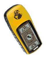 |
5. Using GPS data to refine a mapTutorial: Global positioning systems in forestry. How a GPS works. Practical: Import GPS data. Create map layers showing positions of veteran trees.
|
|
 |
6. Using a GIS for planning and projectionsTutorial: Use a database to make simple projections (future composition, timber volume production etc.) Practical: Create a map showing management operations 5 and 20 years from now for a single year (areas allocated to planting, thinning, weeding, felling, position of access routes etc.) Produce a summary costing of these operations at current prices.
|
| Web page designed and written by Nick Brown. Last updated on 7th March 2002. Any comments and suggestions to nick.brown@plants.ox.ac.uk. |